

How are different industries leveraging drone technology to drive sustainability?
Drones are an important tool for industries to lower their carbon footprints and create more sustainable operations. While an earlier article focused on the sustainability aspects of drone delivery for retail firms and logistics companies, this article provides a broader context on how different industries are leveraging drone technology to identify and measure unwanted emissions to limit or eliminate them.
Identifying unwanted emissions quickly
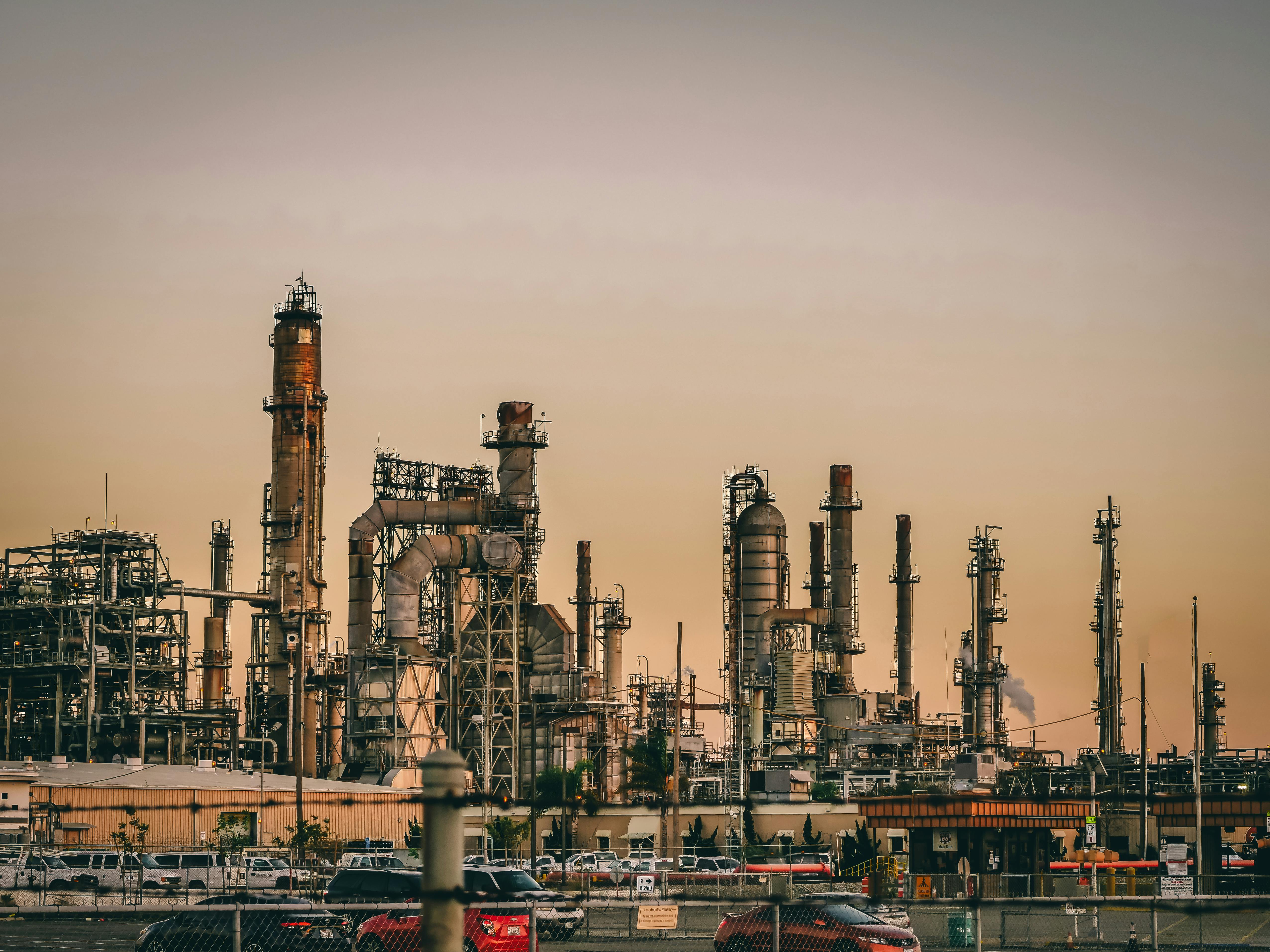
Whereas retail firms and logistics companies use drones as a substitute for existing road-based transportation, industries such as oil & gas, transport, and agriculture now use drones equipped with sensors to provide low-cost identification of unwanted emission sources rapidly.
As the examples below demonstrate, drones are primarily used as a tool to capture environmental data from above the ground without putting humans at risk. Drones carry different sensors and other electronic devices such as IMUs and GPS, enabling them to take large amounts of highly accurate measurements. Real-time data feeds to the end user allow quick detection of emission sources. Subsequent action can be taken to create a more sustainable environment.
Detecting and measuring emissions with AUSEA technology
Methane is a greenhouse gas with a global warming potential 28 times higher than CO2. Detecting methane emission hotspots quickly helps improve air quality and advance companies’ sustainability goals.
One important tool that helps companies detect and measure emissions is AUSEA, which stands for Airborne Ultralight Spectrometer for Airborne Applications. AUEA is designed for real-time, high-precision detection of methane (CH₄) and carbon dioxide (CO₂) emissions using drones or small aircraft. In combination with a drone, AUSEA can access difficult-to-reach emission points such as chimneys while delivering high-precision readings.
AUSEA was primarily developed by energy company TotalEnergies, which is using it to reach its objective of near-zero methane emissions for its operations by 2030. Over time, the company intends to use the technology as part of a seamless and autonomous system that includes an unmanned drone navigation system and automated workflows for data transfer, processing, and additional reporting capabilities. TotalEnergies is also making AUSEA technology available to certain operators so they can carry out targeted detection campaigns on their sites.
Methane detection at landfills
Symbiotica is a spin-off from the University of Bari Aldo Moro (Italy). It uses drone technology for its environmental projects. Symbiotica’s work explicitly targets the reduction of landfill methane emissions, as landfills are major sources of potent greenhouse gases. Rapid monitoring of landfill emissions is essential for a waste sector that aims for substantial emissions reduction and effective waste stream management.
After using SPH Engineering’s SkyHub onboard computer with an integrated methane detector, the company sped up its methane emissions screening workflows by a factor of three. The deployment of drone technology marked a significant leap forward for Symbiotica, as it introduced improvements in speed, safety, precise emissions mapping, and the automation of emission monitoring processes. After using drone technology, risky and limiting on-ground inspections were no longer necessary.
The scale and effects of methane emissions from landfills have led to stricter regulations in the US. Here, the Environmental Protection Agency has imposed fines on methane leaks, which could exceed $600,000. Such leaks can be detected quickly and precisely using a drone with a TDLAS Laser Falcon sensor, which is only sensitive to methane.
Drones for remote inspection monitoring
Similar to how drones have revolutionized logistics, they allow for remote infrastructure inspections, which minimizes the need for traditional transport methods such as trucks and vans. Additionally, drones improve safety, reduce costs, and increase data accuracy.
How drones are transforming infrastructure inspections is explained in an extensive article from Dronedesk, which covers eight different methodologies for drone-based inspections, including lidar, thermal imaging, photogrammetry, and AI. All eight methodologies are included in a comparison matrix listing indicators such as resource requirements, expected outcomes, ideal use cases, and key advantages.
Lidar for example, allows for detecting subtle structural anomalies that might be invisible to the naked eye or traditional camera systems. This makes it well-suited for inspecting complex or difficult-to-access infrastructure, high-voltage lines, bridge structures, or power line corridor mapping and vegetation management. It covers the latest technology in automation, such as Beyond Visual Line of Sight (BVLOS) inspections, combining precise flight planning software, detect-and-avoid systems for obstacle management, and multiple communication systems (cellular, satellite, and radio links).


Comments