

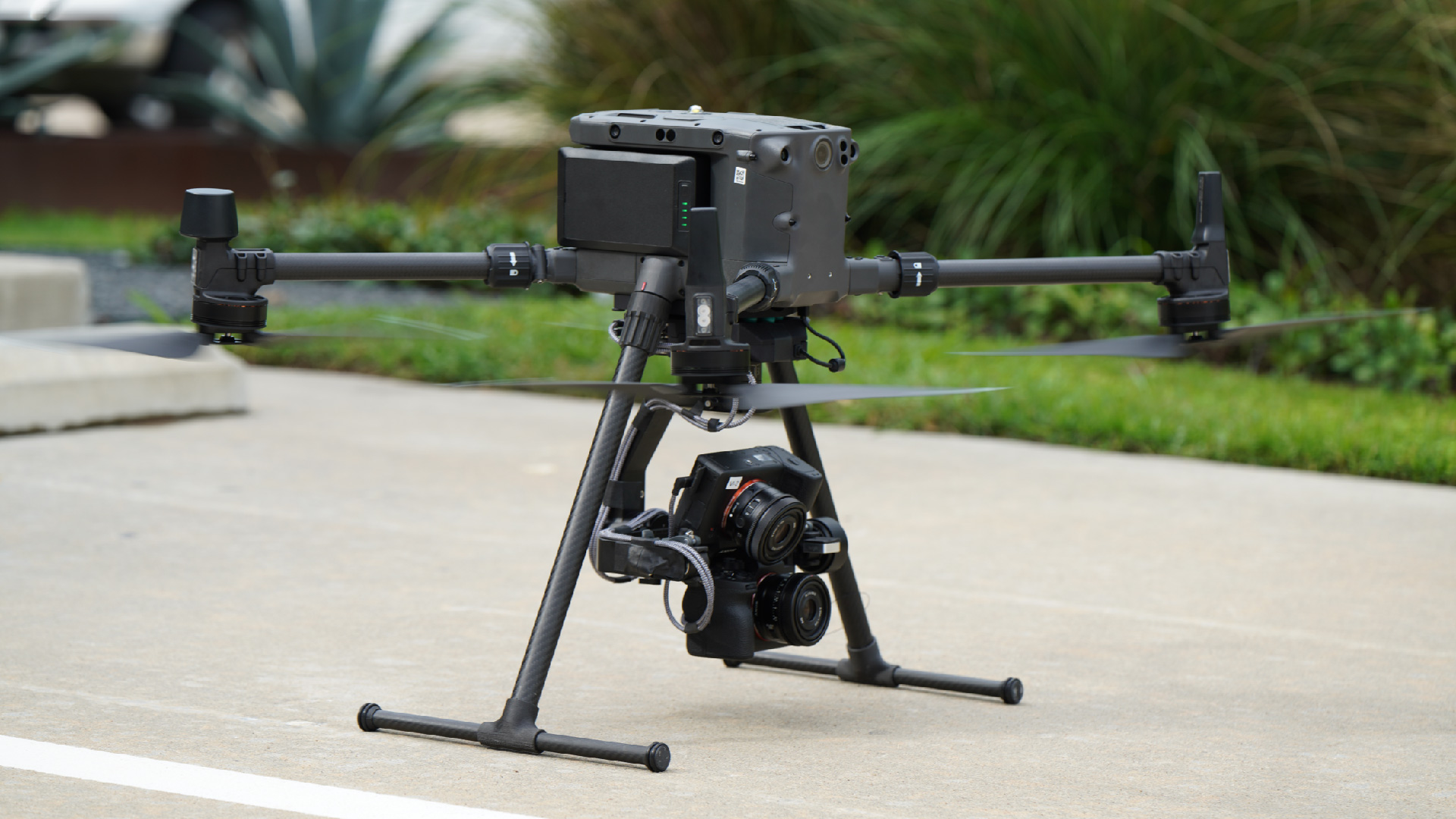
Built to collect “Engineering Class 3D” (millimeter accuracy and 99% coverage) data across the telecom, utilities, rail, and energy industries, Visual Intelligence’s (VI) patented MACS-3D dual-camera sensor system digitizes physical infrastructure to millimeter accuracy. While many companies have shown interest, the payload weight limited it to a class of drone not many organizations or DSPs want to support. Now, VI has launched a lightweight version of the sensor, featuring a compact design that fits various drones and a lightweight payload that provides increased compatibility with smaller commercial class drones—including the DJI M300.
“The single biggest constraint to drone data accuracy is the sensor payload, and most sensor payloads cannot deliver a class of 3D data to engineering teams that eliminates site visits or automates structural analysis,” said Ted Miller, Founder and Chairman of VI. “This new lighter version of our patented sensor is key to expanding access to operators for scalable engineering-grade data collections worldwide.”
Developed to meet the demands of asset owners who require a precision 3D reality model for engineering applications, the lightweight MACS-3D sensor module helps enterprises address physical infrastructure managing challenges across every phase of the lifecycle. It includes dual 61-megapixel cameras (122 megapixels total) and a multiple axis gimbal, achieving a GSD of up to 0.5mm at 10m+ from target and featuring a high field of view (FOV) to target ratio for greater asset coverage. According to VI, the sensor is “50-100 times more accurate than standard off-the-shelf consumer drones and 10-20 times more accurate than mobile lidar sensors.”
As the first unified drone sensor and software platform capable of digitizing physical infrastructure to millimeter accuracy, VI isn’t only about sub-millimeter accuracy sensors. By partnering with Bentley, Microsoft, Sony, and Trimble, VI also provides users with a software and analytics platform to automate flight operations and data transformation, and visualize, inspect, plan, and analyze assets in a 3D environment. By automating nearly every facet of the asset insight supply chain from one platform, VI believes the millimeter class digital twins it generates will solve the drone accuracy gap and are the missing link to unlocking drones, automation, and analytics.
“We generate billions of tower datapoints to map exponentially more measurable surface area than any alternative method,” reads the “Why Millimeters Matter” Towers Guide. “Our sensor-software duo digitizes physical infrastructure with millimeter accuracy, reliably delivering 3D engineering-grade tower intelligence—resulting in better lifecycle decisions, improved engineering analysis, and reduced costs of ownership. For drone data to live up to its promises to the tower industry, millimeter accuracy is the prerequisite.”


Comments