

In 1990 I had the privilege to work with a group of pioneers in Canada in the early development of land surveying techniques using a revolutionary new technology known as global positioning system or GPS. In those days there was only a handful of satellites and the availability of a workable constellation that would allow for an acceptable precision was just a few hours a day or, in some cases, night.
In those days everything related to GPS was new and our team, headed by Paul Mrstik and James Ferguson, continually came up with ideas on how to improve accuracy and efficiency of the few short hours available for measuring. Adding a radio to a base station and a receiver to a rover gave us differential GPS, or DGPS.
That was a great solution for static points but given the weakness of the constellation, we had to stay put on each marker for a few minutes to obtain an acceptable solution. Then came the challenge of obtaining the same level of accuracy by moving the rover around in what came to be known as kinematic GPS, or as it is called today real-time kinematic or RTK.
But RTK was not precise enough for some geodesic work, so a new alternative had to be developed and that came in the form of post processing kinematic or PPK in which you execute the route of the rover in its entirety and then process each point using the base data that corresponds to the time signature.
Given the computing power at the time, this was a cumbersome alternative but with great prospects for the future.
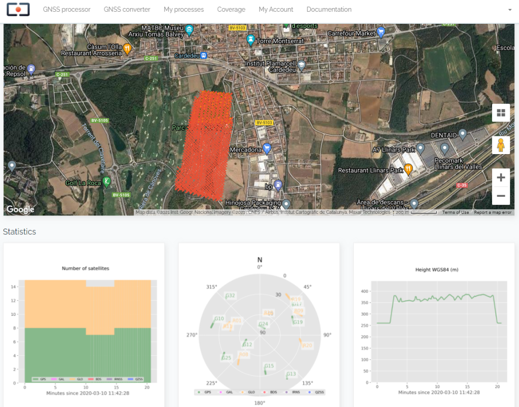
Now 30 years later, and with more than one constellation and over a hundred satellites available, a new alternative to make PPK accessible and fast has emerged and it comes in the form of cloud processing. A company in Spain, Rokubun has launched Jason, a simple solution to most PPK jobs worldwide.
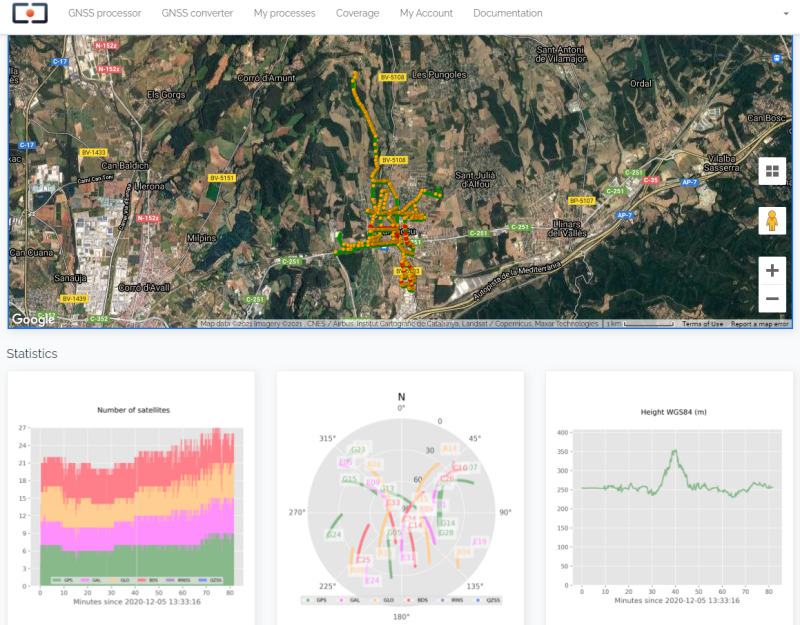
“Jason works with rover data in Rinex format (receiver independent exchange format) uploaded to our processing engine in the cloud,” explained Isaac Hoyas Ester, Navigation Support Engineer at Rokubun. “We have a network of accessible base stations throughout the entire world that provide the stationary data that Jason would process in conjunction with the customer rover data.”
Given the availability of all this free data being generated constantly and available for free, land surveyors now have the possibility of only recording rover data and then using the system to supply the base data.
“This provides our customers with a tremendous advantage in terms of pricing and equipment requirements,” Isaac said. “From the beginning we aimed at creating an affordable service and our price scheme reflects our firm intention to make PPK accessible to all land surveyors.”
With the increased number of surveying professionals using ground mobile laser scanners and mapping drones, the need for PPK is growing exponentially, and Robukun is determined to get a large piece of the action.
“We offer Jason in four payment terms, Pay-per-use, Professional, Premium and Custom and the idea is to offer flexible terms in order to make the service accessible to more people around the world,” stated Isaac. “We also offer on our website a map that shows where all the base stations are located worldwide, so users can determine the degree of coverage available for their job in advance.”
Clearly Jason, as a cloud processing service, offers land surveyors all over the world the opportunity to use PPK without the need to have a base station and, therefore, save on extra equipment expenses and become more competitive. We welcome these innovative approaches that are certainly democratizing our profession beyond the wildest dreams we had in 1990 when a handful of satellites, long sessions and slow laptops were the norm.


.jpg.small.400x400.jpg)


Comments