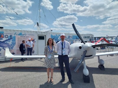
Altitude Angel, a leading UTM (Unmanned Traffic Management) technology provider and INVOLI, the market leading low-altitude air traffic data provider recently announced a strategic partnership that will give Air Navigation Service Providers (ANSPs), operators, pilots and drone-centric risk management applications an unrivalled picture of airspace. The partnership will help define the requirements for UTM both now and in the future.
INVOLI and Altitude Angel have worked successfully together in various competitions such as the Gulf of Finland trials throughout the summer of 2019 and most recently at the African Drone Forum and Lake Kivu Challenge 2020, in which they delivered their unique air traffic awareness system and drone tracking solution. The benefits of these brief partnerships were clear to both organizations, so it made sense to move from an informal working relationship into a strategic partnership.
By integrating INVOLI’s complete and reliable low-altitude air traffic awareness data stream with Altitude Angel’s airspace and ground hazard data, via its GuardianUTM platform, a true situational awareness picture of the drone ecosystem will be created. This in turn will enable organizations who are adopting UTM technologies to have a best-in-class enriched data source.
In addition, Altitude Angel will also have the ability to propagate the data from INVOLI to other applications and partner platforms, including, DroneSafetyMap.com, Guardian App, and bespoke national drone apps from ANSPs.
We reached out to Chris Forster, Altitude Angel Chief Operating Officer and Manu Lubrano, CEO of INVOLI for a more detailed definition of what each of their companies brought to this unique approach to UTM.
“There are many differentiators between Altitude Angel and the other businesses competing in the UTM/U-space arena,” Forster said. “Our technology is best-in-class chosen by some of the biggest players in aviation safety, including NATS and LVNL, and is used in daily operations at international airports, by major drone insurance companies and software and hardware manufacturers, like DJI, around the globe.”
“We’re also innovators,” Forster elaborated. “We’ve brought to market our tactical and strategic deconfliction service, CRS, which will be a pillar on which regular automated BVLOS flight will be built. And only last week we announced a space-based UTM platform, which will bring critical airspace situation awareness and conflict resolution to remote areas and those affected by natural disasters anywhere on the planet, at any time. And in a market which demands the highest standards, we have become an established business which is trusted by the aviation industry and in doing so earned and built a strong reputation. When we say we have a capability, we have it: and we deliver it; on time, every time.”
“As two of the world’s most progressive organizations whose shared aim is to open our skies safely and securely to regular, automated drone flights, I’m excited by our partnership with Altitude Angel,” Lubrano added. “The next few years are critical for the drone industry, and we’re pleased to have Altitude Angel at our side to enable safe drone use worldwide.”
Altitude Angel's airspace and ground hazard data is already integrated into leading drone-centric risk management applications, including Airmate, Skywatch and Dronecloud. The data supplied gives operators a unified view of the airspace to ensure they can fly safely—whatever application they are using.
Strategic partnerships, like the one INVOLI and Altitude Angel have formed, are a clear demonstration of how two businesses with a mutual vision for future drone flights can collaborate and, in doing so, move an entire industry forward. The addition of INVOLI’s data to Altitude Angel comprehensive platform will hopefully bring new clarity to the airspace picture and bring BVLOS flights a step closer.


Comments