July 12, 2019
GeoCue unveils LiDAR-imagery fusion sensors with True View line
GeoCue unveiled its new True View line of drone sensors in late June in during an industry event in Nashville, Tenn., showing off the new tech that will offer surveyors an innovative lidar and dual oblique mapping camera configuration integrated in a single lightweight payload.
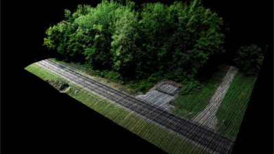
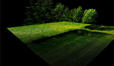
True View allows for fast, easy automated generation of true 3D colorized point clouds, oblique imagery and orthophotos from a single flight.
"Today it seems most drone mapping is performed either with a LIDAR or a camera," Lewis Graham, GeoCue's president and CTO, told Commercial UAV News. "With a camera system, the data are processed into a colorized point cloud but it is a surface model only. With LIDAR, you get nice penetration of vegetation canopy, sharp definition of overhead structures such as conveyors but the best you have is a rough grey scale intensity.
"When imagery is combined with drone LIDAR, it is typically just to provide a contextual orthophoto mosaic. Our system creates a LIDAR point cloud where each point is colorized directly from the camera via ray tracing," he said. "This means areas such as the sides of buildings are geometrically modeled with the LIDAR and then colorized with the imagery."
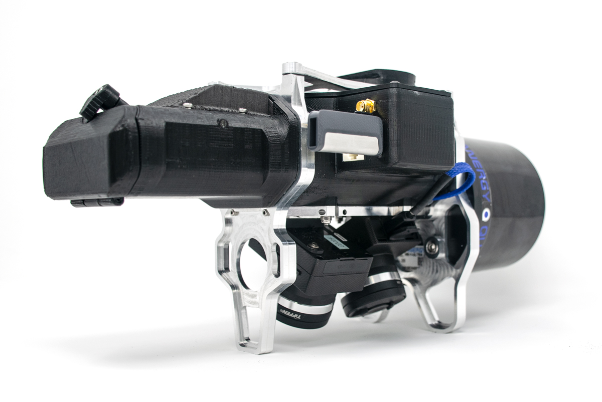
The first sensor of the product line, the True View 410, was displayed at the reveal along with full workflow processing in the companion True View Evo processing software. The sensor features dual GeoCue Mapping Cameras, a Quanergy M8 Ultra laser scanner and Applanix Position and Orientation System (POS). With its wide 120-degree fused field of view, the True View 410 provides high-efficiency 3D color mapping with vegetation penetration in a payload package with a mass of about 2 kg.
An additional benefit is the included processing software, True View Evo," said Graham. "True View Evo performs all steps in the post-processing workflow to move data from raw sources to the output products. Even the processing of the Applanix positioning system is integrated into True View Evo. "
This launch follows the integration of the new
DJI Phantom 4 Pro RTK into their AirGon Sensor Processing Suite
in December.
The True View line of drone sensors has been in development for several years, in spurts.
"We have very close relationships with our clients and have listened to their needs as their experience level with drone mapping matured. They really do not like the fact that there are always some bad data in point clouds derived strictly from imagery," said Graham. "LIDAR gets around this issue but at the loss of the richness that true color provides. Our customers want an affordable system that solves these problems. This was the real motivator for the True View 410."
Graham sees the True View sensors as a solution for companies who are doing structure from motion (SfM) mapping using a drone-based camera but are up against the limits of the technology.
"I really think colorized 3D point clouds will rapidly become the base mapping expectation for most high accuracy drone mapping applications," he said. "This leads me to conclude that anyone who is doing drone mapping where SfM does not adequately represent the object space being modeled will have an interest in migrating to our True View technology."


.jpg.small.400x400.jpg)


Comments