

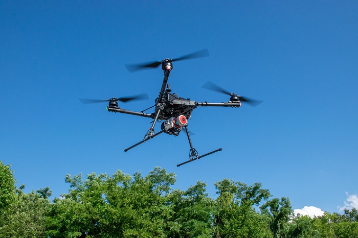
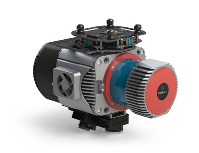
With the release of GeoCue’s three new, high-end TrueView 3D Imaging Systems, surveying and mapping professionals can take their drone-based operations to new levels. The Alabama-based company’s TV625, TV680, and TV680LR offer customers access to a full range of advanced-level systems for collecting LiDAR and photogrammetry.
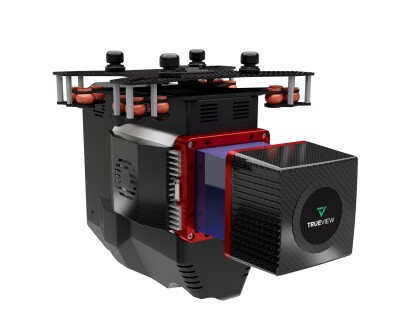
Each system combines a lightweight and compact laser scanner with three cameras for enhanced accuracy and efficiency in geospatial data collection. The TV625, TV680, and TV680LR—all designed and built in the US—are NDAA compliant, which aids not just surveying and mapping professionals, but anyone in construction, infrastructure management, and environmental monitoring who deploys drones in their work.
To see these systems in person, visit GeoCue, booth 509, at this year’s Commercial UAV Expo.
To learn more about the TV625, TV680, and TV680LR, Commercial UAV News spoke with Madelyne McNab, Director of Business Development at GeoCue. We discussed the product development process, use cases for the new systems, and GeoCue’s plans for the future.
Commercial UAV News: Can you describe specific aerial surveying and mapping uses cases that the systems would be particularly well suited for?
McNab: Most of our customers use TrueView systems for topographic mapping; generating contours, exporting DEMs being the most common derivative of the collected data. Many survey firms have found collecting this information via a UAV provides significant value, cost savings and reduced field time are the most recognized benefits to traditional collection methods.
Commercial UAV News: What kinds of improvements can surveyors and mappers expect to find when using the TV625, TV680, and TV680LR?
McNab: GeoCue has been at the forefront of watching the evolution of LiDAR since our founding in 2003. Being an integrator of sensors, it has been exciting to see the constant improvement to technology over the years. Year after year, we are seeing new sensors introduced to the market that improve accuracy and efficiency. These advancements allow our customers to fly higher for increased efficiency, produce higher quality data and unlock new capabilities, and lastly, on the GeoCue side we’ve made processing workflows easier for new users.
Commercial UAV News: How did GeoCue develop these new systems? Did you work with partners and customers to create the TV625, TV680, and TV680LR?
McNab: GeoCue recognizes the importance of forming strong relationships with survey equipment distributors and drone manufacturers. Collectively we listen to the market and our clients to develop products that meet increasing demands. Sometimes this looks like custom hardware configurations or development of software tools. Through these partnerships, we’ve entered new verticals where LiDAR is just starting to emerge.
Commercial UAV News: What’s next for GeoCue?
McNab: GeoCue will continue to work to deliver the highest quality hardware, simplified software, expert training, and support our customers count on. As we introduce numerous new products to the market over the next year and scale our company to meet the increasing demand, our core value remains the same: to build scalable LiDAR and mapping software, and to provide training and support to ensure our customers’ success.
About GeoCue and Microdrones
GeoCue and Microdrones have joined together to bring geospatial experts the very best in drone surveying equipment, geospatial software, workflow, training and support for high accuracy LiDAR and drone mapping to help civil engineering and surveying professionals achieve successful data collection, processing, and management.
With TrueView drone LiDAR/Imaging sensors, LP360 point cloud data processing software, and fully integrated systems from Microdrones, we are the leader in LiDAR mapping processing in North America able to meet customers where they are in terms of technology adoption, budget, and resources.
To learn more about GeoCue, visit www.geocue.com.
To learn more about Microdrones, visit www.microdrones.com.

.png.small.400x400.png)


Comments