

In Las Vegas at Commercial UAV Expo 2022, there was a wide variety of the most impressive drones available on the market today. But as we know, it's not just the specific drone hardware that makes this industry go, but all of the support hardware and software that operationalizes the drones and allows them to perform their crucial tasks. Plenty of that support technology was on display at Caesar's Forum, including products from Applanix, a Trimble company. Brad Schmidt, Global UAV Sales Manager for Applanix, was kind enough to spend a few minutes with Commercial UAV News at the company's booth to talk about the technology they have to offer the UAV industry.
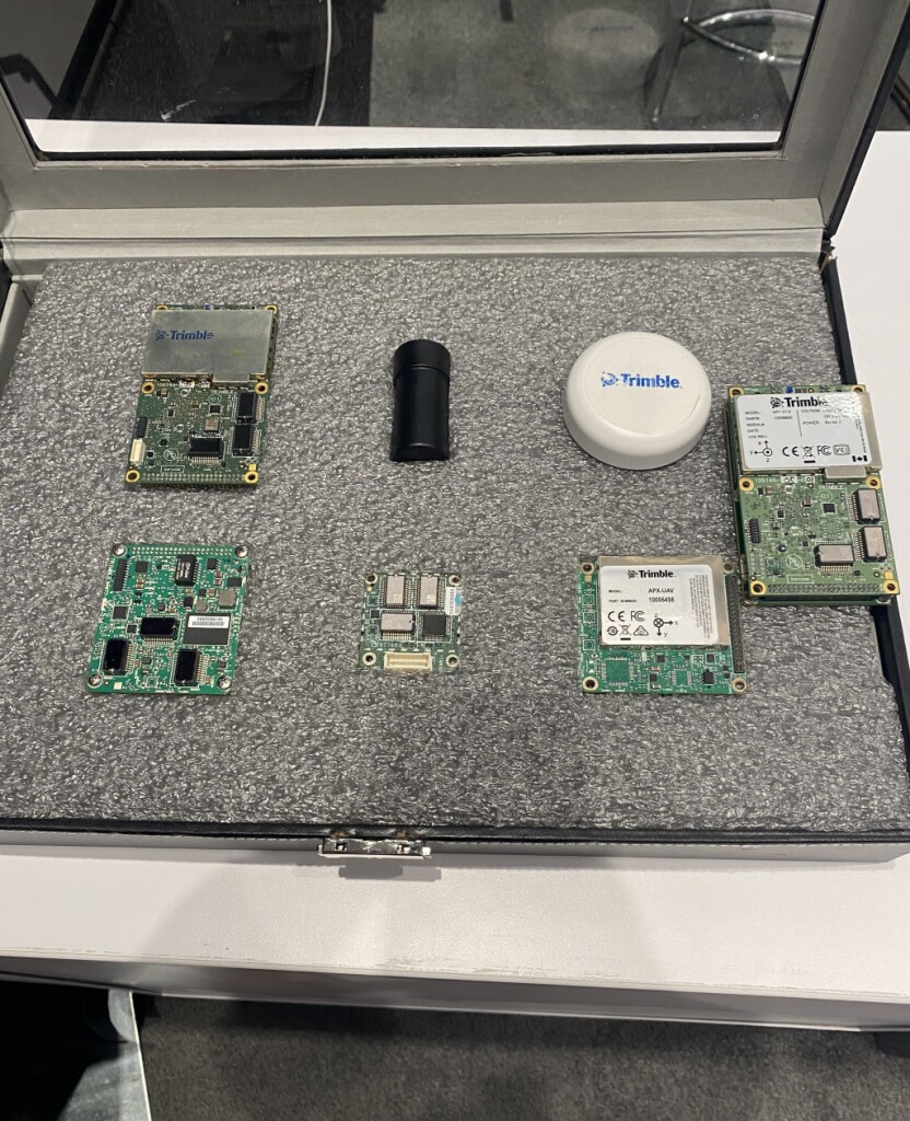
The Applanix UAV Business Unit is a supplier of OEM GNSS/Inertial components for customers that are in the surveying and mapping industry, an industry that, as Schmidt notes, is "all about achieving precision and accuracy." To support this UAV requirement, Applanix provides three key pillars to their solution to provide maximum accuracy: the physical base station or virtual correction solution, a direct geo-referencing solution, for which they have multiple integrated GNSS IMU board sets for different use cases, and their post-processing software called POSPac UAV. All of this, Schmidt said, "gets you into the world of direct georeferencing for UAV surveying and mapping." He added that the solution can provide highly accurate results down to just a couple of centimeters on the ground.
Working with drone and sensor manufacturers as well as systems integrators, Applanix ensures surveyors and other users have what they need to complete their job with plenty of possible use cases. One particularly interesting example Schmidt passed along was for a company in the agricultural industry located in the northwest US. During the winter freeze/thaw cycle, rocks are pushed up to the surface, which can pose a major problem come spring when machines are working fields to plant new crops, as the rocks can lead to serious equipment damage. To mitigate this issue, the company flew UAVs over the fields to precisely locate the rocks, after which they sent a precision robotic rock picker to remove the rocks, which in turn prevented damage to the planting equipment.
That's just one of many possible use cases in the world of surveying and mapping that can be made significantly easier and more effective using this technology. The UAVs themselves are incredibly impressive and effective, but it's the support tools, such as those provided by Applanix, that really maximize their value.

.jpg.small.400x400.jpg)


Comments