

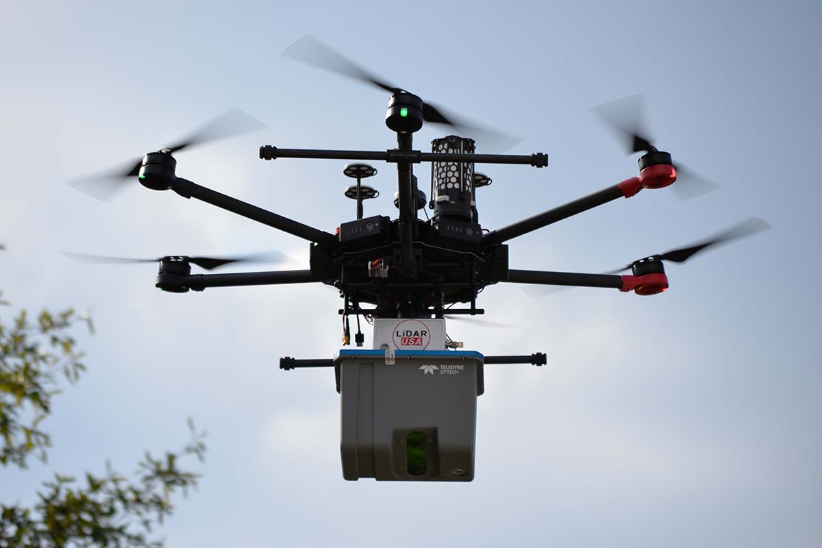
As its first integration partnership, Teledyne Optech chose LiDARUSA to make its new compact LiDAR sensor, the CL-90, available for purchase. Also, LiDARUSA recently announced the integration of their UAV-scanning systems with the Harris Aerial H4/H6 Hybrid multicopters.
Displayed during the SPAR 3D Expo & Conference earlier this year, Teledyne Optech’s CL-90 is a light-weight, compact LiDAR platform featuring improved canopy penetration for excellent ground coverage, much higher downward point density for superior results in corridor/power line projects, and long-range performance for maximum productivity at UAS ceilings.
Founded in 1999, LiDARUSA builds economical UAV & mobile mapping systems, that push technology to the edge using the latest tools for scanning, imaging, and navigation. The company’s ability to support numerous industries with cutting-edge integration makes them an ideal partner for Teledyne Optech’s compact LiDAR sensors.
“The big news is what it means for us and the consumer. We can provide a very good solution for the highest quality UAV LiDAR scans,” LiDARUSA CEO, Jeff Fagerman told Commercial UAV News. “Whereas most vendors would provide such integration with only a single choice for the INS (inertial navigation system), we can provide a working package using the most popular manufacturers and models of INS. So, if the client is already using POSPac, Inertial Explorer, etc, they can continue with whichever they are most familiar with. Of course, they also get the benefit of the LIDARUSA software.”
To provide customers with longer flight times at an affordable price, LiDARUSA is now integrating its UAV-scanning systems with Harris Aerial, an innovative drone manufacturer based in Orlando, FL. The company specializes in battery and gas-electric UAV design, hardware manufacturing, and sensory and custom payload integration for applications spanning various industrial sectors.
“Harris is a small company, like all of the other gas-electric hybrid companies, and is located in Florida,” Fagerman explained. “After a bit of research (by us and several customers) we found Harris to be flexible, willing to listen and incorporate small changes, and the proximity on the east coast was helpful.”
By using a small generator running on 95 (or higher) octane fuel, Harris Aerial’s H4 and H6 carrier hybrid drones can fly for up to 5 and 3 hours, respectively. For example, the H6 can carry an A-series HD LiDAR system of 3kg for 2.5 hours and a V-series of 5kg up to 1.5 hours.
“The hybrid is important for some users who do projects generally beyond the scope of most survey projects,” Fagerman said. “While it is possible to scan 1000 a day with an A-series HD (using a Velodyne HD scanner, for example) on a DJI M600 multicopter with flights just under 20 minutes, doing the same project on a system that can scan uninterrupted for 2 hours significantly reduces field time. Six 20 minute flights are not the same as one 2-hour flight. Staying on course for a couple of hours makes a big difference.”
According to LiDARUSA, “as an integrated package with any LiDARUSA scanning system, the price is still well within reach of most mapping companies”.
Starting on September 17th until the 19th, LiDARUSA will debut Innoflight Technology’s Galaxy 950 at Intergeo with the CL-90. Later on, from October 28th to the 30th, the company will showcase more products at the Commercial UAV Expo 2019. In the future, Fagerman said they will announce “several new scanners, cameras, and vehicles”.


Comments