

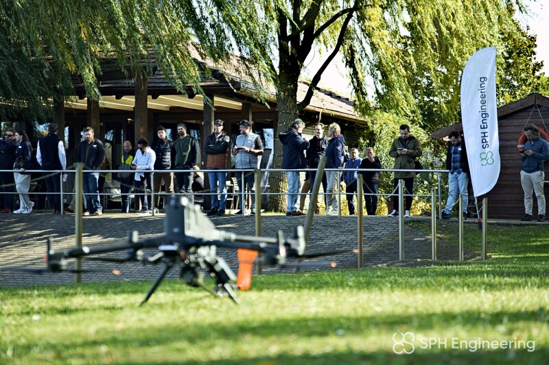
Last week, Commercial UAV News attended SPH Engineering’s Drone Camp event, held October 12 and 13 outside Budapest in Vasad, Hungary. The two-day event was, in the company’s words, “built for people who make decisions with drone data,” and was free to attend. Attendees could network with industry peers and see live geophysical demonstrations, expert presentations, and the announcement of winners of SPH Engineering’s Global Drone Operations Awards.
We’ll start with the awards portion of the event, for which the company sought submissions from teams who are “pushing the limits of commercial drone and unmanned field operations.” With submissions across a handful of categories, projects needed to improve on proven workflows and show measurable results. SPH Engineering chose a panel of five judges who pored over each submission individually before meeting to choose winners in each category. As a disclosure, the author of this article was one of the judges, along with Cian B. Dawson of EEGS FastTIMES, Jan Franke of Geolitix, Becky Bodger of Bentley Systems, and SPH Engineering CEO Alexey Dobrovolskiy.
The winners of these awards were announced at the event, and a representative from each winner accepted in person. In all, four organizations were chosen as winners, with one each in the categories of mining operations, construction & site intelligence, and academia & research. Additionally, judges awarded one organization a jury special recognition award. The winners were as follows:
- Mining Operations: AB Surveying Solutions SpA, for its work mapping buried utilities to support a primary crusher relocation. The organization ran terrestrial and drone-mounted ground-penetrating radar (GPR) side by side at an active mine site in Chile to map buried utilities, producing a validated subsurface map that fed into an excavation design.
- Construction & Site Intelligence: Medusa Geoservices, for their use of drone-based gamma-ray measurements to investigate peat thickness at an onshore wind development. They used drones to survey peatland in Ireland that could not be walked on foot in order to produce maps and depth measurements of the peat.
- Academia & Research: San Diego Zoo Wildlife Alliance, for using drones to collect breath samples from killer whales. Using a drone fitted with petri-dish mounts, the organization flew a few meters above surfacing killer whales from a moving research vessel to collect breath samples from endangered Bigg’s and Southern Resident killer whales without invasive biopsy.
- Jury Special Recognition: Embry-Riddle Aeronautical University, for developing a Remote Split Operations model that lets students around the globe research unfamiliar sites, plan faculty-supervised missions, and analyze collected data.
Beyond announcing the award winners, the event also featured presentations from three other judges in attendance. Dobrovolskiy led a series of live demonstrations throughout the event and served as the overall emcee. The demonstrations featured live flights outside the venue, as well as walkthroughs of software workflows after data collection. Specific technologies featured included ground-penetrating radar, bathymetric sensors, magnetometry, and more.
Additionally, Francke, another jury member, gave two presentations on ground-penetrating radar. Francke is a global leader in GPR, having developed custom GPR systems for use cases including mining, archaeology, and exploration across diverse environments. His first presentation explained how GPR works and its evolution to today, and the second focused more specifically on drone-based GPR.
Finally, Bodger, a geoscientist and Technical Solutions Manager with Bentley Systems, presented on software workflows after collecting geophysical data. Using Seequent’s platform, she gave a live demonstration on how those in the room can best work with drone-acquired subsurface data, answering questions and offering tips to maintain the most efficient workflow.
Although the geospatial industry was one of the earlier adopters of UAS technology to complete work in space, the SPH Drone Camp event emphasized how much innovation continues within that vertical. Across industries like mining, construction, research, and more, sensors for collecting data and software for processing and analyzing it continue to evolve rapidly, making what seemed impossible years ago routine. This was evident in the submissions to the Global Drone Operations Awards and in the presentations and live demonstrations in Hungary.







Comments