


Mapping continues to be one of the most common uses for commercial drones in 2022. There’s a lot of drone mapping software on the market, but which one is right for you? Finding the right software for your use case is critical to creating maps and models that will give you and your clients the measurements and insights you need.
Here are six of the top drone mapping software options for 2022:
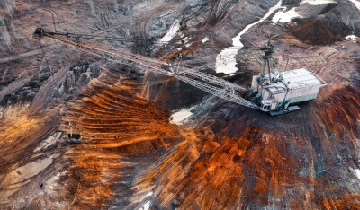
1. DroneDeploy
DroneDeploy is a user-friendly, cloud-based software that lets you capture, process, and analyze data all in one platform. You can create high-resolution 2D and 3D interior and exterior maps and models that are accurate to between 1 and 5cm.
It’s designed for individuals, teams, or enterprises and is ideal for all use cases and industries. However, DroneDeploy's primary markets include agriculture, construction, mining, energy, roofing, and inspection.
What sets DroneDeploy apart is its unique features, which include:
- Mobile Flight App – Fly and capture images directly from your iOS or Android device.
- Live Map – Create real-time, sharable 2D maps as you fly.
- Autonomous Flight – Preprogram your route and let the AI do the rest.
- 360 Walkthrough – Take a 360-degree, virtual tour through a 3D model of your entire site.
There are also a number of industry-specific features, such as Plant Health that helps farmers measure crop health and viability.
DroneDeploy offers a 14-day free trial, and it works with dozens of third-party apps, including Procore, Autodesk Construction Cloud, Airmap, and Agremo.
2. Pix4D
Pix4D is the only fully-hybrid drone mapping and photogrammetry software on the market, with mobile flight, desktop, and cloud-based platforms. This is a tool for enterprises and advanced users that gives you survey-grade accuracy down to less than 1cm.
It provides industry-specific applications for mapping and surveying, construction, agriculture, telecom, public safety, mining, inspection, and manufacturing and integration. It also offers a variety of data capture applications and data capture devices.
Pix4D isn’t cheap, but it provides some of the best versatility and high-quality maps and photo-realistic 3D textured mesh images on the market.
3. SimActive
Correlator3D is SimActive’s patented high-end photogrammetry software that is not only used from drones, but also from airplanes and satellites. It’s designed to work with any type of UAV platform, camera, and sensor. However, it is currently only available for Windows computers.
This tool gives you the ability to create an unlimited number of high-resolution, survey-quality images (and reports) and process them faster than with most UAV software.
It’s designed for large projects in surveying, construction, agriculture, mining, forestry, and emergency response, and has been put to use in a number of scenarios, including agricultural resource monitoring and natural disaster damage assessment.
SimActive offers optional data processing as a service. If you provide geotagged images and projections, SimActive’s professionals will turn them into DSM, DTM, orthomosaic maps, textured mesh 3D models, and survey-quality reports.
4. Propeller
Propeller is a turnkey solution that easily integrates into the workflow for earth-moving industries such as mining, construction, and waste management. It’s designed to make the drone survey and analysis process more efficient so survey teams and field crews can collaborate more effectively, visualize changes in 3D, and track progress.
All you have to do is choose from one of Propeller’s supported PPK drones, then fly and capture your high-quality imagery, with accuracy down to 1/10 of a foot. Once you’ve captured your images, you can easily drag and drop them into the software. Propeller’s experts will process the images for you and return survey-level reports and maps within 24 hours.
Propeller also offers various ground control points (AeroPoints and DirtMates) to help provide more precision and accuracy to your data collection.
You can have an unlimited number of users with one Propeller account, and you can share maps to field crews via Propeller’s mobile app.
5. Maps Made Easy
If you’re new to professional drone piloting and are looking for an inexpensive way to create orthophoto maps and 3D models, Maps Made Easy is for you.
It’s a web-based application that gives you the option to subscribe or pay-as-you-go. It also offers a free plan with unlimited map processing for up to 1 gigapixel and access to its Map Pilot Pro companion app on up to 4 devices. (Map Pilot Pro is only available for iOS.)
Maps Made Easy is just that: easy. It lets you capture high-quality imagery with relative accuracy within 1%. And the fact that Maps Made Easy will process your images for you and turn them into textured 3D models, point clouds, colorized DEMs, and more means there’s little effort on your part to get professional-quality maps and models.
6. Raptor Maps
Raptor Maps is a software-as-a-service for the global solar power industry. It provides solutions for all aspects of solar operations – drone data capture is just one of the things it does. It offers three tiers of UAV service with various flight altitudes, capture times, and detail levels for reporting and mapping.
As part of its UAV service, Raptor Maps deploys its own network of drone pilots to capture high-resolution infrared thermal images down to 3cm and HD RGB images down to 1cm. These images are then processed and analyzed to give you identifiable anomalies.
What Raptor Maps reports varies by the service tier you choose and can include insights on offline inverters and combiners, anomalous strings, physical and visual module damage, in-depth technical analysis on photovoltaic (PV) systems, and more.
Finding The Software for Your Use Case
So which drone mapping software should you choose?
DroneDeploy is a great option if you want mobility, portability, and extensive features, but Pix4D might be a better choice if you need more precision. SimActive is a solid option for large projects, while Maps Made Easy is a great entry-point if you’re just getting started in drone mapping.
If you’re looking for a tool to use in an earth-moving industry, consider Propeller, while Raptor Maps is ideal for the solar power sector.
Everyone always asks what the best drone mapping software is, but that's the wrong question. There's no single "best" software out there, and some are better suited for a given task or job than others. The right question to ask is: which drone mapping software best fits your needs, industry, and level of expertise.


Comments