

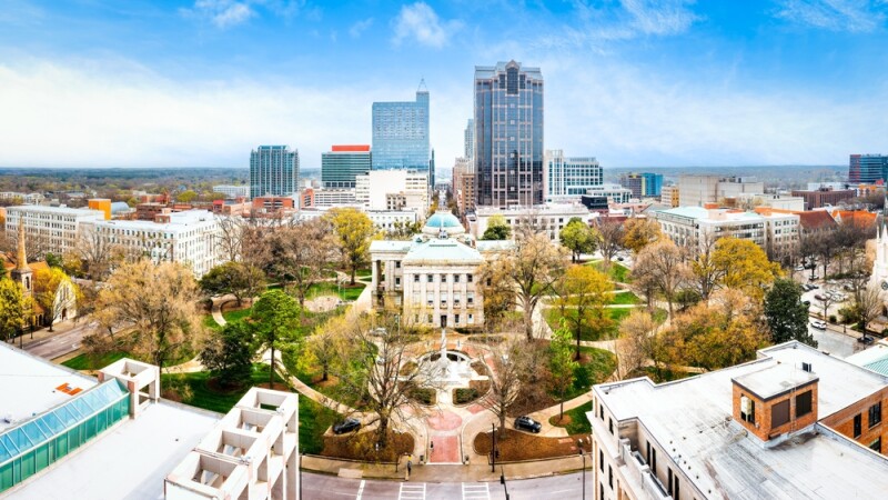
While we typically hear about drone programs for large enterprises, federal projects, or law enforcement groups, local government agencies are increasingly turning to the technology for a growing range of uses. As anyone who has been following this industry closely for the last half-decade knows, sensor technology has evolved nearly as quickly as the innovation around the aircraft itself, and for collecting an increasing amount of different types of data – be it RGB, lidar, thermal, or most other types – using a drone is the most efficient option in the toolbox. They can and are used for one-off inspections, to be sure, but we’re now also seeing more promise for UAS to be a source of feeding city-wide systems that can be used in a myriad of ways – internally, across departments, and even in public-facing ways.
Recently, Commercial UAV News spoke with Jim Alberque and Jeff Dawson, the GIS and emerging technology manager and supervisor of the technology and analytics group within Parks, Recreation and Cultural Resources, respectively, with the city of Raleigh, North Carolina. The city is currently building what it describes as a “living digital twin”, combining reality mapping data with its Esri-based GIS data. Alberque shared that there are three main buckets in which the city is planning to use this tool: planning, operations and modeling, and public storytelling.
Before getting into more specifics around these ultimate use cases, and even the processes used to collect the data, it’s worth starting with what the city is actually building. Anyone who works in the construction or urban planning spaces knows that “digital twin” is something of an amorphous term, meaning different things to different people. For this project, Alberque admits that the city (understandably) doesn’t dwell too much on a specific definition for this term, but says generally it’s “the idea of using a digital platform to be able to model what the city was, what the city is, and what the city could be.”
For the sticklers for the digital twin definition, though, it’s worth noting there is real-time or near real-time data being fed into the model from IoT sensors.
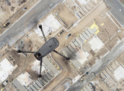
Among the keys to really fueling this digital twin product, though, has been the evolution of Raleigh’s drone program. Dawson has been behind much of this growth, telling CUAV News that things really got started back in 2018 for one-off inspection projects. The big spike in interest, however, followed the Dreamville Festival, a music festival that formerly ran on an annual basis in the city. As part of the setup and execution of the event, tractor-trailers had to drive through Dix Park, and it happened to come after a rain event, leading to significant damage to the area. This wasn’t unexpected, but the scope of the damage was difficult to assess from ground level. That’s where drones came in.
“Ground-level images were tough to really display what that scale of impact was going to be. So we flew that and did the initial assessment of that,” Dawson said. “Being able to demonstrate that scale resulted in something like $60,000 worth of turf repair that the festival management company or producer funded. That was a quick and immediate direct impact that we were able to make or contribute to.”
Anyone who works in local government – or any line of work, really – knows that this kind of example is not always available when trying to prove the value of a certain tool.
“This is one of these examples where there is a real, linear line between drone-captured imagery and a dollar figure return on investment,” Alberque said.
From that moment forward, different departments started seeing the value in the technology, and the program has continued to evolve, not just in scope but also with the regulatory winds. Dawson noted that the program started with a DJI Mavic 2 Pro with Drone2Map as the main software of choice. However, they noticed chatter at the federal level about potentially banning Chinese-made drones, and as more departments showed interest in using the hardware, he knew a change was necessary.
So, today the program uses the Free Fly Astro, with multiple departments beyond just Parks, such as Water and IT, sharing usage. That common platform, so to speak, benefits everyone involved.
“[Starting from] a decentralized drone program across the city, having a common platform that we’re all using is helpful because not only can we assist Jim’s group, but Jim’s group is going out and flying for us now,” Dawson said.
Today, simply collecting data is no longer the biggest challenge for a project. Instead, that headache has shifted to combining that data with data from other sources, whether it's a terrestrial sensor, GIS data, IoT data, or something else. To really get value out of this digital twin, this data combining was a critical step for the city, and something that both Dawson and Alberque said was eased with the shift from Drone2Map to Site Scan, from Esri, a switch that has led to much less manual effort.
“I won’t say that it is end-to-end automated, because it’s not,” Alberque told CUAV News. “But the manual steps involved are definitely reduced significantly.”
The digital twin's uses are already showing value across the community, for both internal departments and the public. As mentioned above, Alberque envisions three main buckets of uses for the tool, with planning being the most obvious given the city’s recent population booms. According to one analysis, Raleigh was among the 25 largest population increases between 2023 and 2024, meaning the city needs significant development to keep up with population growth. This digital twin brings together relevant data and imagery to plan new developments and monitor their progress over time.

One of the most exciting uses for a digital twin like this is simulation, using existing imagery and IoT data feeds to model spatially accurate scenarios for planning. Alberque shared one example of this focused on climate and weather. Working with Aeris, which uses NOAA data to simulate heat conditions in different neighborhoods, the city has combined its internal data with Aeris’ “micro-scale heat modeling” to get a fuller picture of how heat is impacting different parts of Raleigh. This not only helps simulate potential effects of development scenarios, but the data is also shared in a public-facing storytelling format to show how different areas are experiencing heat in the city.
Looking ahead, Raleigh is still in the early stages of developing and using the full potential of this digital twin. Key milestones ahead will help the drone program, which fuels much of this data collection, move forward. Specifically, Dawson noted that passing Part 108 and the ability to complete projects requiring BVLOS flights could be an important step for the program, though he doesn’t anticipate that work could begin immediately after Part 108’s final rule is released.
That said, he pointed to a recent project of collecting data around City Hall as an example of where BVLOS could come into play, as the project has involved the drone going around corners and losing connection and control. He also called out easement inspections from the city’s Water Department and emergency management on local trails.
“We have 100-plus miles of greenway trails that we have to maintain,” Dawson said. “And so for us, BVLOS would be interesting predominantly from an emergency management perspective of looking at damage along long stretches of linear corridors.”
The idea of a drone as a tool within a larger project keeps coming up across the commercial industry, and this work in North Carolina is a clear example of that. The data collected by the drone, while certainly valuable in its own right, is no longer the selling point. Instead, it’s a major piece of this larger digital twin that, as Alberque said, showcases what the city was, what the city is, and perhaps most importantly, what the city could be.






Comments