

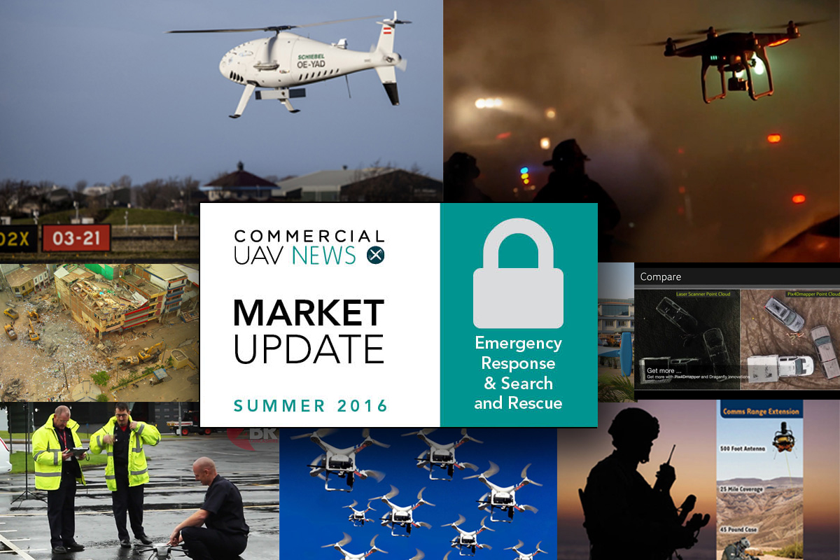

Emergency Response & Search and Rescue

 Tethered drone for tactical radio networkSyntonics announced a new drone-based network range extension product, the High Antennas for Radio Communications-Tethered Drone (HARC-TD) system.HARC-Tethered Drone provides dramatically improved network and communications range extension for tactical radio communicators, first responders, and similar users of mission-critical radio networks. A lightweight expeditionary system, HARC-TD extends Ultra High Frequency radio communications as far as 25 miles in all directions, including over elevated terrain and down into valleys and urban canyons.HARC-Tethered Drone is small, minimizing its profile when flying, relatively quiet because of its ducted fan, and its ducted fan makes the UAV safe to handle. The airborne drone is electrically powered via its tether and can fly for hours or days from either battery or generator power. HARC-Tethered Drone is optimized for network/data/voice communications with military and civilian radios. And are not prone to interference as the signal to the antenna travels by optical fiber. The system, which was presented at 2016 Special Operations Forces Industry Conference (2016 SOFIC) in Tampa, Florida, can also be applied to areas as search and rescue.
  10 years of Camcopter S-100Ten years after the first delivery of Camcopter S-100 to the launch customer, the Vienna-based Schiebel company celebrates the anniversary of its world class product, which has played a key role in the NGO Migrant Offshore Aid Station (MOAS), whose operation has saved the lives of thousands of migrants in the Mediterranean Sea.The development of the unmanned helicopter from Schiebel started in 1995 and once the first Camcopter S-100 was supplied to the UAE Armed Forces in 2006, it took only three years before Schiebel had sold the 100th aircraft. During its ongoing production since then and in line with the company’s philosophy of permanent performance enhancement, the Camcopter S-100 UAS has undergone continuous improvement in order to meet the ever growing demand for new capabilities from its worldwide customers.
 Besides the excellent S-100 performance, the characteristic Camcopter design has won various awards and the helicopter has made its way into the permanent collection of the Museum of Modern Art (MoMA) in New York. The system is also displayed at a most prominent location in the Vienna Technical Museum. UAVs for Crash Scene ReconstructionOne area where UAVs may play an important part in the future is in the crash scene reconstruction. The National Criminal Justice Research, Test and Evaluation Center (NIJ RT&E Center) is performing an operational evaluation of UAS for Crash Scene Reconstruction. The objective of this evaluation is to evaluate the utility of a UAS to support crash scene reconstruction in an operational law-enforcement setting.The study will determine whether a UAS could be used to improve crash scene reconstruction in terms of quality, safety, timeliness, or other metrics. Based upon previous investigations, the Center has identified a number of agencies that have operational UAS capabilities configured to support law enforcement. The Center is now seeking to partner with those or other interested agencies in order to complete the operational evaluation. The focus of the study is on the use of UAS for crash scene reconstruction; however, information on alternative uses of UAS in law enforcement is also requested.Follow the link for more information about this study from the National Criminal Justice Research, Test and Evaluation Center.
  Drone for Lancashire Fire and RescueLancashire Fire and Rescue, UK, released some photographs taken by their new Aerial Support Unit: a drone. Which can be seen in action in a video from Two Boroughs Radio (known on air as 2BR), a local radio station serving South and East Lancashire. TV Station 2BR.According to 2BR, “emergency services in the area will be using drones to help find missing people and get a better view of large blazes. Chief inspector Gary Crowe said that the drone will help to provide ‘an extra tool when it comes to tackling offenders, protecting the public and responding to major incidents’.In the interview for 2BR Chief Fire Officer Chris Kenny said that "From an operational perspective, for firefighters, the ability to see the full extent of an incident and identify hazards from a distance is a leap forward in improving how they can tackle the fire and protecting their safety. The drone will also be used by police, and Lancashire Police and Crime Commissioner Clive Grunshaw added:"Being able to call upon the drone to provide real-time footage will save vital time, provide officers the information they need to make potentially life-saving decisions and be significantly cheaper to operate than the police helicopter." For the full story and video follow the link to 2BR website.
  India wants 150 UAVs for combat SARSimultaneously with the first flight of India’s new combat- capable UAV, Rustom-II, which will fly in Chitradurga test flight range from the end of July to early August, and India’s Ministry of Defence expects to use as US’s Predator, the MOD has issued a combined tri-service requirement for the acquisition of up to 150, medium altitude long endurance (MALE) UAVs.According to the article published by Flight Global, The UAVs are to perform a range of tasks from artillery adjustment, combat search and rescue (SAR) and coastal/maritime patrol to urban security, disaster control and protection of facilities. India’s hot and high requirements mean that the UAV and its subsystems should remain operational across temperatures ranging from -40 degrees centigrade to +55 degrees centigrade.The request from MOD indicates that the UAVs are proposed to be developed and manufactured by the Indian industry. To read the whole story visit the Flight Global website.
  European Emergency and DJI test First ResponderEENA (European Emergency Number Association) and have entered a partnership to understand and evaluate the use of RPAS (Remotely Piloted Aircraft Systems) or UAVs (Unmanned Aerial Vehicles) in Civil Protection/First Responder scenarios in a number of pilot sites in Europe.The main objective for the project is to learn how such technology can assist our Fire and Rescue Services, Emergency Medical Services (EMS), Police Services, Coastguards and Humanitarian organizations in different scenarios and in different environments such as urban, rural, mountainous, forest and “over-water” conditions.The application period closed in April and four test sites have been selected, in Ireland, Denmark, United Kingdom and Iceland. The timeline for setting up the pilot test site is between May and September 2016. Both EENA and DJI will be in constant touch during the Programme to get regular feedback and progress reports and may do site visits to address specific questions and to gather first hand data. Find more info on the European Emergency Number Association webpage.
  GlobalMedic saves lives with UAVsWhen Nepal was struck by a 7.8-magnitude earthquake, in April 2015, GlobalMedic arrived to assist Nepal’s population with a fleet of UAVs equipped with tools that helped to save lives. In April 2016, after a 7.8 magnitude earthquake struck the coastal region of Ecuador, GlobalMedic was again on the ground using UAVs as an important part of its aid and relief program.Aeryon Labs UAVs have been used by GlobalMedic. Aeryon says it is proud to assist NGOs and other organizations on the front line of disaster response. In recent years Aeryon has also supported international relief efforts by providing aircraft and pilots in Kathmandu (April 2015 earthquake) and Philippines (the December 2014 Typhoon Hagupit response).Mapping of the hardest hit regions and damage assessments help to determine where help is needed most. In partnership with the government of Ecuador, our UAV teams have mapped thousands of acres in areas heavily affected by the earthquake. These images have been compiled into maps and provided to the National Secretariat for Risk Management to support their response and provide detailed situational awareness. To read more about GlobalMedic’s aid and relief programs, visit their website.
  Drones are a faster way to survey accident scenesAlthough drones are still looked upon, by many people, as nothing more than prying eyes up in the sky, the reality is much different. Drones are present in multiple areas of our daily routine and revealing how they can make our life easier. For example, drones are to become a standard part of the toolkit for surveying accident scenes. Their use has proven benefits and potential to revolutionize the way we deal with vehicle crashes.In a study by Unmanned Experts, Drew Jurkofsky, a Colorado police officer and accident reconstructionist with nearly 20 years experience, found that using a drone for accident documentation instead of traditional methods cut time spent in the roadway to nearly one fifth, and measuring time to around one third.Having a highway closed for hours while the accident is documented is always a problem. Specialists say that drones make the task easier, and that the larger the accident area, the better the efficiency of a drone to collect the data.To read the whole story, follow the link to the article 4 Reasons Drones will Revolutionize Accident Scene Response.
  Drone Swarms for Search-and-Rescue OperationsThe FAA is not comfortable with the idea of one pilot being in control of multiple aircraft up in the sky, but it may well have to change opinion and adjust the legislation. Because drone swarms are a logical step in at least two areas: agriculture and SAR operations. That’s what Charlton Evans, commercial aviations projects manager with Insitu, told website Inverse.“The agriculture world wants that, search and rescue wants that” said Evans, adding that “it’s cost-efficient if we can fly multiple aircraft off one guy, that makes sense to everybody. But, then doing that in the national airspace in a way that does not increase risk is a hoop we’ll have to jump through.”The article, under the title Drone Swarms Will Soon Be Used for Search-and-Rescue Operations, explores how the use of drones in disaster situations as the recent earthquakes around the world can help the work of the SAR teams on the ground, and how going from one single drone to groups of drones can make the whole process faster. Follow the link to Inverse to read the whole story. Want to see something included in our next Market Update? Send us an email or get in touch with us on Twitter or Facebook.


Comments