
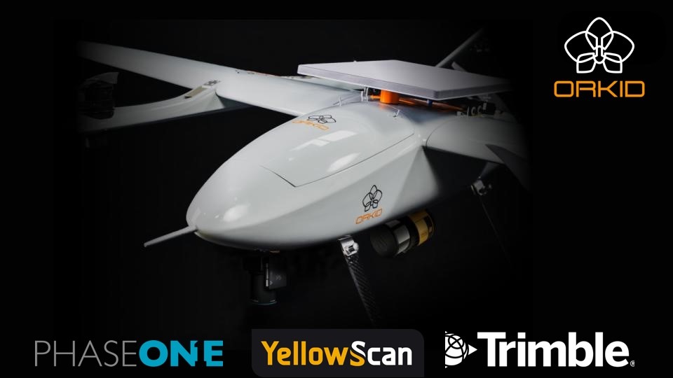
October 7, 2025 — Aerospace firm ORKID has introduced a new variant of its ORKID 260 drone. .png.small.400x400.png) According to a press release from ORKID, the ORKID 260VTOL is “the world’s first vertical take-off and landing (VTOL) drone to bring all four of the most advanced aerial data capture technologies together—onboard, fully integrated, and operating simultaneously.” These technologies are lidar (YellowScan Surveyor Ultra), photogrammetry (Phase One P5 camera), GNSS/IMU (Trimble Applanix APX-RTX), and Native Starlink SATCOM integration.
According to a press release from ORKID, the ORKID 260VTOL is “the world’s first vertical take-off and landing (VTOL) drone to bring all four of the most advanced aerial data capture technologies together—onboard, fully integrated, and operating simultaneously.” These technologies are lidar (YellowScan Surveyor Ultra), photogrammetry (Phase One P5 camera), GNSS/IMU (Trimble Applanix APX-RTX), and Native Starlink SATCOM integration.
ORKID said that the UAV is “built on a 100% electric, NDAA-compliant architecture” and offers an estimated flight endurance of 1.5hr / 75 miles.” The drone, ORKID asserted, “is engineered for mapping, surveying, utilities, oil & gas, defense, and critical infrastructure inspection.”
Remarking on the announcement, Santiago Pinzon, CEO at ORKID, said, “For the first time, you will be able to fly one aircraft, on one mission, and capture survey-grade LiDAR, ultra-high-resolution imagery, centimeter-level positioning, and control it all live over Starlink — from anywhere in the world.”
Source: Press Release


Comments