

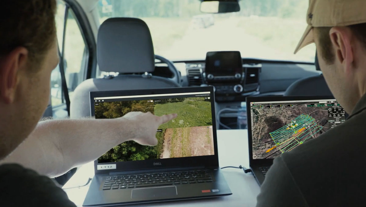
SPH Engineering is developing a solution to stream live video and data from a drone at the site to a single command center. With this, all video streams, 3D maps, placemarks, and other incoming drone data provide law enforcement and first response operations with access to real-time overviews, analysis, and in-depth investigations.
Based on SPH Engineering’s drone mission planning software Universal Ground Control Software (UgCS), the UgCS Command & Control “is a scalable solution, offering rich functionality and an intuitive interface, and tailored to manage complex SAR, investigation or surveillance operations from anywhere in the world”. The system can be easily integrated with existing Enterprise and Command center infrastructure and is available in two different versions: the Team Edition, best for mobile operation centers; and the Enterprise solution, for headquarters, command and monitoring centers.
UgCS Command & Control is currently being used mostly in Search and Rescue (SAR) missions, as it increases safety with software’s terrain-following and 3D map features to fly at any terrain type. It also helps to conduct SAR operations more effectively by using an automatic search pattern tool and achieves results faster by managing multiple drones simultaneously.
However, it is also designed for Law Enforcement and First Response operations to enable more precise situation assessment, decision making and effective management of first responder teams in order to provide a more efficient resolution of a disaster situation. It also helps to facilitate security of vast territories by dispatching drones triggered by alarm and managing regular drone patrolling.
By displaying video streams from various drones in real-time, command center operators are not only able to have a better awareness of the ongoing mission but also to take manual control over the camera of a specific drone. For example, if the operator sees anything suspicious, they can hold the drone’s current mission and take control of the camera to focus and zoom in on the object. Once the issue is dealt with, the operator can continue the drone’s mission from where it left off.
Additionally, command center operators can track the real-time location of a drone, mark points of interest for detailed onsite investigation or take manual control over a drone. Also, drone pilots can create placemarks to transfer images of a point of interest to the map view of the command center operator.
Founded in 2013, SPH Engineering is a software developer and integration services provider for unmanned systems. The company is best known for its UgCS software but is always looking for new solutions for safe and efficient UAV integration in different industries. For example, earlier this year, the company also launched an Automatic Vertical Scanning Tool for Drones.
For more information, or to request a demo of the UgCS Command & Control system, SPH Engineering asks you to contact them.


Comments