
UAV technology is showing great potential for breaking down communication barriers on construction projects and making planning faster, easier, and more accurate.
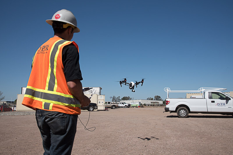
On large construction projects, it can be difficult to gain an accurate, timely understanding of the state of the project. A big site with dozens, if not hundreds, of people from several different companies means there are many moving parts and communication is a constant challenge. This is where UAV technology can make a big impact.One important application for drones in the construction industry is site logistics, which includes coordinating where and how materials should be delivered and stored, where heavy equipment should be moved, and when and where work should be performed.For example, at DPR we have used frequent, high-definition aerial imagery captured by UAS to create project site maps to communicate scheduled work, coordinate site logistics—such as material deliveries and equipment movement—and capture project progress for owners, subcontractors and the surrounding community.The UAV images provide project teams—contractors, subcontractors and suppliers—a quick and easy site map to communicate the safe and timely movement of people and equipment around a busy jobsite. These drone-generated maps are particularly valuable on a fast-track project that includes modular and prefabricated systems with varied laydown areas.However, the workflow to gather UAV data safely on a construction project, plus the infrastructure to post-process the data—which often includes several thousand photos, photogrammetry, laser scans, and so forth—into a useful map requires planning. It is a challenge to create a system that collects and compiles all the data in a useful, easily shareable format in a live collaborative environment.As UAV technology continues to generate excitement, we must consider the potential of these solutions when the drone lands. Data is the lifeblood of our ability to build a project with speed, safety and quality. UAVs have tremendous potential to support all those key elements on a jobsite—if we establish a data management infrastructure that will let the data collected from a UAV take flight.Subscribe
The information you submit will be stored and used to communicate with you about your interest in Commercial UAV News. To understand more about how we use and store information, please refer to our privacy policy.
August 3, 2015
Is Your UAV Data Ready to Take Flight?

Want more stories like this? Subscribe today!


Featured Report
Featured Authors More Authors ›

Featured Authors


Newsletter Signup
Our Events


Our Events
September 1-3, 2026 • Las Vegas
February 23-25, 2027 • Salt Lake City
Comments