Many people think flying a drone and capturing images is easy. There’s little argument that the logistics around what it takes to get a drone in the air have come a long way over the past few years, and with so many courses and workshops available, there’s plenty of opportunity to hone these skills, especially in the classroom. Is that enough to be professionals successful with a drone though?
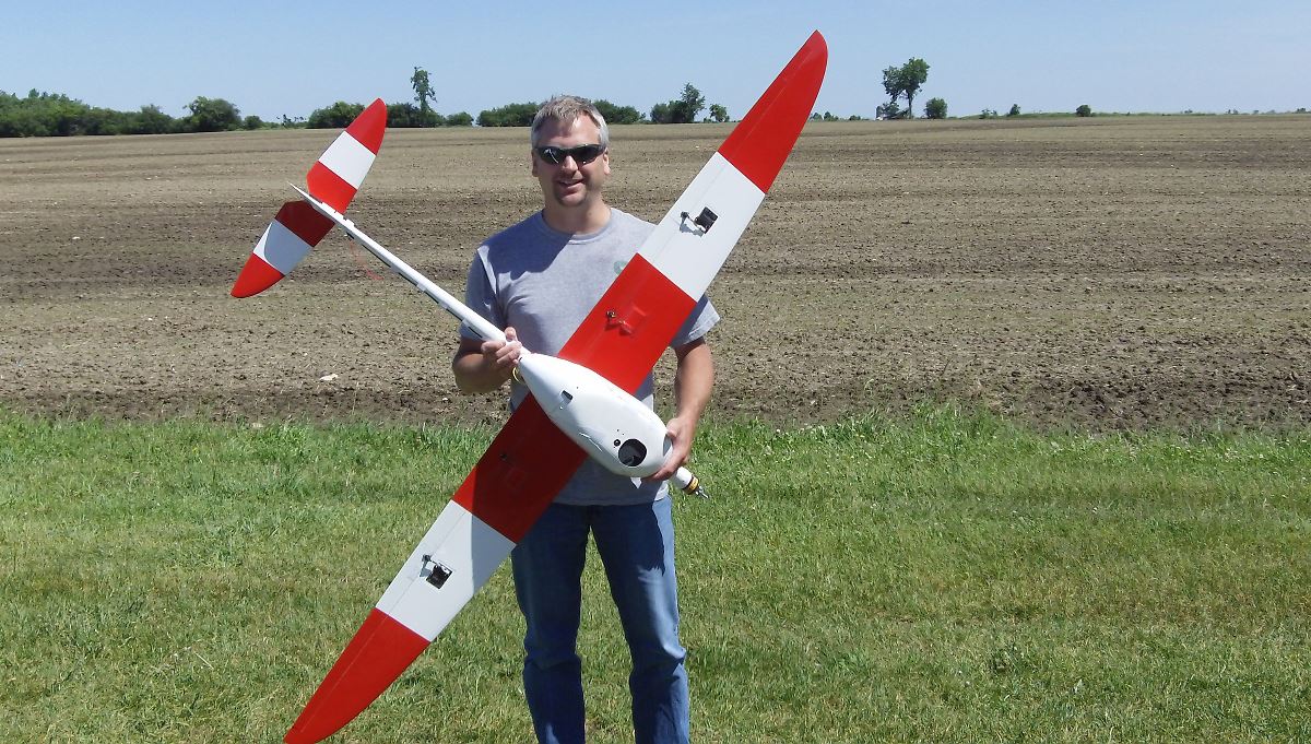
To find out, we got in touch with Robert Goodwin, the Senior Geospatial Analyst at Remote Sensing & GIS (RS&GIS), Michigan State University. Robert is involved with drones in agriculture and hands-on drone training, as the University has created these training programs to tie how to fly UAVs together with data collection and geographic data analysis. The three-day workshop is focused on what it means to use drones to collect, process and analyze data through a Geographic Information System (GIS).Find out what Goodwin has to say about how drones have impacted the approach professionals can take, how the class might expand beyond Michigan, what has him excited about the future of the technology and plenty more in the interview below. Commercial UAV News: You’re a GIS & Remote Sensing Analyst at the Michigan State University. Can you explain to our readers exactly what that means in terms of the work you do?Robert Goodwin: RS&GIS is a self-funded research and outreach group at Michigan State University. As a geospatial analyst I am responsible for implementing spatial workflows to enhance MSU research activities, providing education to MSU faculty & industry professionals and completing GIS data development and analysis projects for public and private entities. This increasingly includes UAVs. You’ve been with the RS&GIS (Remote Sensing & GIS) at Michigan State University since August 1998. What’s your position there and what’s a normal working day at the office?I am the Senior Geospatial Analyst at RS&GIS. As the project manager for the analyst group, I am responsible for overseeing two full-time analysts as well as several technicians. A typical day includes meeting in the morning with the analyst group to review project status, trouble-shooting and reviewing timelines and budget. This is often followed by researching new business activities and then “heads-down” geospatial analysis. During the flying season, a day would also often include 2 – 4 hours in the field collecting multi-spectral imagery data using UAVs. Periodically throughout the year I will present on various geospatial topics at conferences/industry meetings or teach professional workshops. How, when and why did you get involved with drones? Was it immediately because of your work or did it start as a simple interest in the technology itself?Throughout its 45-year history, our group has always been involved in Remote Sensing activities. In fact, we began as a NASA grant-funded land cover project and grew from there. Working with “drones” was a natural fit for us, both because of our remote sensing expertise and our background in all things geospatial. In 2011 we were approached by a potential client that wanted to investigate drone use for turf applications. At the time, I had been discussing drones with my colleague Dr. David Lusch but we were unsure as to the best way to begin. The turf application provided the initial funding we needed to get started. We began with an Aeromapper Fixed-Wing UAV carrying a Tetracam ADC Lite. Since that time, we have deployed numerous rotor-craft carrying numerous sensors, including more advanced multi-spectral sensors and a thermal sensor. In addition to turf, we have collected and processed data for cash crops, specialty crops, switchgrass, drains and more. Personally, I believe that there is a bright future in the specialty crop industry. You’re one of five persons from the RS&GIS (Remote Sensing & GIS) at named on the registry of Certified GIS Professionals, which is based on a stringent certification process which requires years of experience in the field, continued professional development, and service to the GIS community. Has that certification changed, in any way, the way you work?That list is a bit out of date. There are now 4 of us that hold the certification. My colleague Dr. David Lusch has recently retired. That being said, the GISP certification has not changed how we work but it has been an asset when responding to funding opportunities. Clients seem to be listing the requirement more often which helps RS&GIS overall. In the past, two other of our staff have held a GISP. However, they have let the certification lapse because their focus is predominantly application development. You’ve worked as a wildlife technician for the MSU back in the first half of the 90s and at the United States Forest Service in the second half of the same decade. Aerial photography was used then for some of your work, but nothing like we can achieve now with drones. Looking back at that period, would the use of drones have changed the work you did then?Geospatial tools and data have changed dramatically since the late 1990’s. I remember carrying a PLGR GPS receiver in one hand and a 1:40,000 scale NAPP color-infrared photo in the other as I navigated through the woods using a 100’ tape. The PLGR is now in a museum and aerial film photography is all but dead. It is hard to say how much drones would have helped back then because the workflows were not built around having access to such a tool. Today, professionals in natural resources, agriculture and other fields are building new workflows that take advantage of the high-resolution and multi-temporal capabilities of UAVs. For forestry applications drones would have certainly helped with our understanding of forest canopy and stand structure and for wildlife applications we could have used drones to complete thermal animal surveys or map habitat at a finer scale. Has your diverse background experience regarding nature helped you to do a better work now?First and foremost, I truly believe that in order to succeed in the geospatial industry it is necessary to be a lifelong learner. Technology changes so quickly that constantly learning is the only way to keep up. That being said, I believe I am fortunate to have worked in natural resources early in my career because it was those experiences that first taught me how to think spatially. Whether it was tracking radio-tagged grouse using telemetry or navigating through the woods as a timber cruiser using a compass and an aerial photograph, I was always thinking spatially. Sometimes it was simply, “Where the heck am I?” At other times it was understanding the lay of the land to know I was in the right plot location marked by a pinprick on color infrared photograph. I continue to draw on those skills, particularly when designing UAV missions, interpreting land cover or completing topographic analyses. Drones and photography are important elements for scientific research, but as you said recently, “drone imagery by itself is not terribly useful”. Is that the reason why you’re involved with the creation of a three-day, Hands-On Drone-to-GIS workshop, focused on the process of using drones to collect, process and analyze data?Today anyone can fly a drone and collect some pretty stunning video or even still photography. That data can be very useful for activities such as inspections, crop scouting and marketing. However, if the goal is to quantify a landscape condition, it is necessary to move that data into a Geographic Information System (GIS). I have observed a startling knowledge gap in this regard. Everyone wants to fly drones and they have seen what is possible, but they lack the necessary geospatial knowledge to do it for themselves or analyze the data properly. Additionally, because simpler tools are now available, many folks are now able to process the data but don’t really understand what they have and/or don’t know how to extract the necessary information. The class we are offering this year is designed to fill the existing knowledge gap by teaching researchers and professionals the entire workflow - how to collect data properly (and legally), process the data correctly and analyze the data spatially. You’ve announced that several workshops will be offered April through September 2017 at MSU or Northwest Michigan College. Do you have plans to extend the offer into 2018 and expand it beyond Michigan?We are very excited about this course because it is the only one we know of that teaches the entire workflow from planning to GIS data analysis. That being said, it is difficult to predict how people will react. So many people just want to get into the air and take pictures. This class is not for those people. Instead, we are looking for folks who want to utilize drones professionally in a way that advances their industry. Based on attendance this year, we will determine how best to move forward.I believe that the training will continue into 2018. I also believe that this training will spawn other training courses, perhaps an entire professional curriculum built around GIS and Drones. It is too early to determine if the course will be taken on the road. A lot will depend on demand. However, professionals living in other states are more than welcome to register and attend. Enrollment in our other workshops often includes professionals outside of Michigan. Do participants on the workshop need to have previous knowledge or experience? Who should attend the workshop?This course is designed for anyone with moderate computer skills that are physically capable of manually operating a remote controlled vehicle. The principles and techniques are not overly complicated, simply new to most people. While there is no specific targeted industry for this course, professionals in the fields of engineering, construction, agriculture, planning and natural resource management are a natural fit. UAVs, however, have many uses, so anyone interested in learning how to fly and collect & process data are urged to attend. Does this workshop open professional opportunities to the participants?From the standpoint that this course offers participants the chance to learn a broad spectrum of techniques, this course will open up professional opportunities. The UAV industry is actively growing and the addition of geospatial knowledge will only help those looking to find work deploying drones. Are there other workshops planned that go beyond the essential aspects covered on this three-day workshop?No additional workshops are currently planned. However, RS&GIS offers additional GIS software workshops and Northwestern Michigan College offers a Remote Pilot Certificate prep course. We hope this course will spawn additional training opportunities, perhaps even an entire curriculum. What excites you most when it comes to utilizing these tools moving forward? Based on the evolution in technology and industry that you’ve already seen, what has you excited about where things will go from here?I guess I am most excited about three main items.First, improvements in battery technology that allow for a 3x or more increase in flight time. This is a roadblock to many applications and improvements in power will be a game changer on the same level as the invention of inexpensive digital cameras. Increased flying time will expand UAV use to areas currently only practical from manned aircraft.Second, I am really looking forward to more advanced, but affordable multi-spectral and hyper-spectral sensors. Up until just a couple of years ago, sensor advancement had lagged behind platform advancements. That is finally changing as manufacturers are building narrow-band sensors that utilize onboard radiance calibration. The next step is to improve the spatial resolution of those sensors.Third, it will be amazing to see how drones become the next common tool, similarly to the way GPS has evolved. When I began my career, GPS was just gaining popularity. Now GPS (not to mention all the other GNSS) is so common that it is taken for granted. In my view, UAVs will become a tool so common that they are viewed no differently than automobiles. It may seem funny, but cars are actually becoming more like UAVs – self driving. I see a not too distant future where UAVs are used for such activities as wide-area ortho collection, water monitoring, fire suppression and countless other activities. Of course, much of this will depend on regulations and advancements in platform safety.Subscribe
The information you submit will be stored and used to communicate with you about your interest in Commercial UAV News. To understand more about how we use and store information, please refer to our privacy policy.
April 3, 2017
Drones Classes and Workshops: Processing UAV Imagery with a GIS


Comments