

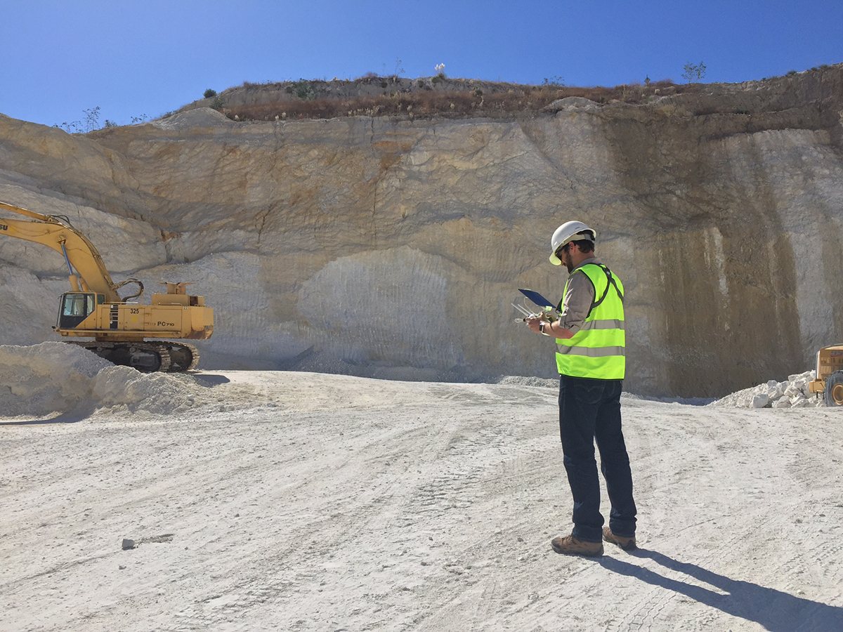
It wasn’t so long ago that the only time a surveyor or engineer would ever operate a drone was in their free time. In industries like surveying and engineering, accuracy and reliability are absolutely essential, and so surveyors have been rightly skeptical to adopt the technology until it can be proven to be reliably accurate. Today though, surveyors are doing more with less, and have quantified a 90% time savings when using the technology. Nonetheless, many people within the surveying and engineering professions still look on drone people with a very skeptical eye.
That’s understandable, and I’ve seen many people burned by getting bad data out of drones. Even more unfortunate is seeing the people out there who are claiming to have the skills to provide the mapping services required for a given job without being able to back it up. Sometimes it’s just a matter of people getting ahead of themselves. I run into many drone pilots who are excellent pilots with impeccable safety records. Many of them are extremely skilled artists and filmmakers as well. But that simply isn’t the same thing as a scientist who can accurately capture and process data. It’s especially frustrating when a company hires a pilot who thinks they know surveying, only to get inaccurate or unreliable data. This makes the company think that drones altogether are worthless, which obviously isn’t true.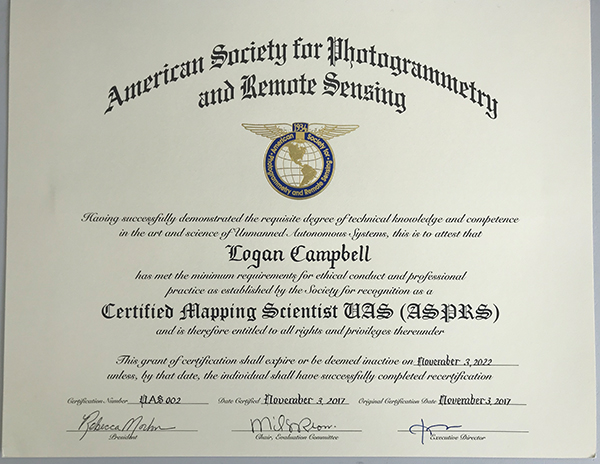 It takes a lot of skill to get survey-grade accuracy out of a drone. There are dozens of small mistakes that can impact accuracy, and the standard operating procedures we’ve developed and refined at Aerotas have allowed us to create incredible efficiencies for our clients using drones. However, they’re also the result of American Society for Photogrammetry and Remote Sensing (ASPRS) standards for positional accuracy to measure and verify the accuracy of your data. That’s just part of the reason that I wanted to be one of the first people to actually get certified when ASPRS launched the UAS Technical Symposium certification program at Commercial UAV Expo last year.The exam covered a much broader set of topics than I would have initially expected. It covered everything from how drones work, through the basics of photogrammetry, all the way to the fundamental physics and math that supports it. I had to draw on my experience from every part of my professional career to be able to pass it, and the validity that certification represents is and will be a big deal for my business. It’s an even bigger deal for the survey industry as a whole though.ASPRS certification matters for a variety of reasons, but for me, it all comes down to credibility. While I first sought out the certification for the perceived value, going through the process of achieving the certification has yielded more practical value than I would have initially thought. The exposure to a much broader set of photogrammetry, remote sensing, lidar, and even radar technology has really helped me understand how aerial surveying can best be done. And that’s value Aerotas delivers to our clients every day.That credibility really does mean something out in the field, where uneducated pilots can mess up an entire project by gathering bad data. We’ve seen flights with just a single line of oblique photos, and two or three ground control points, where the client expects perfect topographical data as a result. As one might expect, the final data doesn’t pass any quality tests, and the data has to be thrown out. However, the bigger problems associated with not having this credibility typically come up during data processing and accuracy measurement.
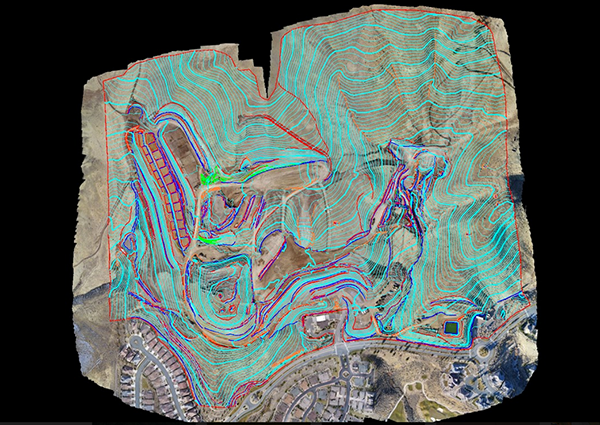
A look at what it means to properly capture and process data gathered via a drone.
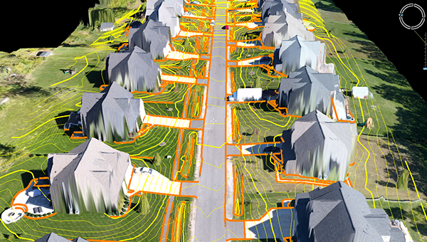 Being a Certified Mapping Scientist means you comprehend the principles of mapping from aerial imagery, and can apply that knowledge in a way that makes sense for real-world projects. There are so many different types of surveys that can be completed with a drone, and they are very different. A topographic map of a real estate subdivision will require a very different workflow than a 3D reconstruction of a historical building facade. Having the expertise to prevent errors before they happen, and catch any errors in a timely manner is the best way to save money. Several companies are starting to make drone-specific LiDAR sensors, but understanding where and how these tools can be best utilized isn’t a simple endeavor. These are just a few of the topics that ASPRS Certified Mapping Scientists can talk through in detail.If you want to get deeper into the field of photogrammetry, the ASPRS UAS Technical Symposium is a wonderful place to do just that. Being a professional in any career requires having the appropriate knowledge and experience to be able to provide a real value to your clients, and ASPRS makes the path to gaining that knowledge and experience a lot easier than figuring things out by making mistakes. Whether you are just getting started on your journey, or just about to take the certification exam like I was, it gives the information you need to become better are high accuracy drone surveying.The attitudes and opinions of surveyors and engineers when it comes to drone technology have certainly changed over the past few years, as many have come to realize that drones are ultimately tools to enable new workflows. There’s still work to be done on this front though, and that’s part of the reason the ASPRS UAS Technical Symposium is so important to the industry as a whole. It has already helped to enable the credibility of the technology, and that credibility is only going to become more powerful and widespread as more and more professionals understand the impact it can enable for accuracy and reliability, as well as the bottom line. Editors Note: The ASPRS UAS Technical Symposium is being offered as an add-on to either Full Conference or Exhibits-Only registrations for Commercial UAV Expo Americas 2018, which takes place October 1-3 in Las Vegas. To register for the event, click here.

.jpg.small.400x400.jpg)


Comments