senseFly, the Swiss manufacturer of mapping drones, has launched new 360 industry-specific solutions for professionals, to reduce costs and collect fast, quality results easily and more efficiently. What was especially interesting to hear was that this development was at least partially the result of the reaction from what the company rolled out at Intergeo 2016.
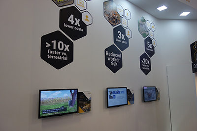
A look at the senseFly booth at Intergeo 2017.
“A lot of this really came out the feedback we got after rolling out our RTK/PPK-ready mapping drone last year,” Francois Gervaix, Product Manager Surveying at senseFly, told Commercial UAV News. “People loved the tools, but they were asking us about a solution. That’s why this year we consciously limited ourselves around new products and have been very solution-focused instead.”
Those solutions are focused on four different sectors which have been created to specifically make sense for professionals working in each. Survey 360 is for surveyors, Mine & Quarry 360 is for mining and quarries, Inspection 360 for inspections and Ag 360 for agriculture. All of these solutions are designed to tie together various tools and capabilities that senseFly has had available, with a focus on how the solution will help users plan, capture, generate and act. Additionally, previous partnerships with
Airware and Pix4D have helped to enable these solutions to be that much more powerful and customizable.
The
Survey 360 and
Mine & Quarry 360 solutions include an eBee Plus drone, senseFly’s eMotion software as well as
Pix4Dmapper for Survey 360. Access to
Airware’s software platform is also included for Mine & Quarry 360. Similar to Survey 360, the
Inspection 360 includes both softwares - eMotion and Pix4Dmapper - but, since it is designed for inspections, the
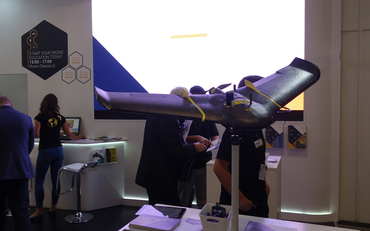
eBee Plus is replaced with the
Albris drone. There’s also the
Ag 360 solution for agriculture, which uses
eBee SQ drone, the
eMotion Ag flight & data management software, and
Pix4Dag image processing software.
senseFly also provides full education & support through free consultancy sessions as well as full access to their online Knowledge Base, regular customer webinars, video tutorials & more. Users can also take advantage of local, expert guidance from authorized senseFly partners as well as lifetime hardware & eMotion support. All of these capabilities and features are designed to give users something that much more complete than had previously been available.
“senseFly 360 solutions provide geospatial professionals with market-proven, ready-to-deploy solutions that cover the whole data collection process,” said Jean-Thomas Celette, Chief Sales & Marketing Officer at senseFly. “Most importantly, as we know from the feedback of senseFly operators around the world, these solutions provide a positive return on investment through helping organizations to boost their efficiency by rapidly reducing their data collection times.”
senseFly has built a good reputation around its drones and their usage in various industries, and these offerings are designed to take those relationships to the next level. These solutions make it easier for new, and current, professionals to pick up a complete package and start improving their business right away.
All of these solutions are available now, and you can find out more details associated with each on the company’s
website.


Comments