

With a focus on providing easy access to data analysis, 3D modeling and mapping through the use of drones, 3DR improved its ground control points processing of Site Scan. Simultaneously, 3DR introduced Lightning. 3DR customers customers have found this workflow to be 5X faster than main alternatives.
Site Scan is the only end-to-end drone data platform to offer GCPs cloud processing. It is 3DR’s complete drone-to app-to cloud system that makes it safer and easier for enterprise and commercial users to collect and process aerial data, perform inspections and improve business operations.
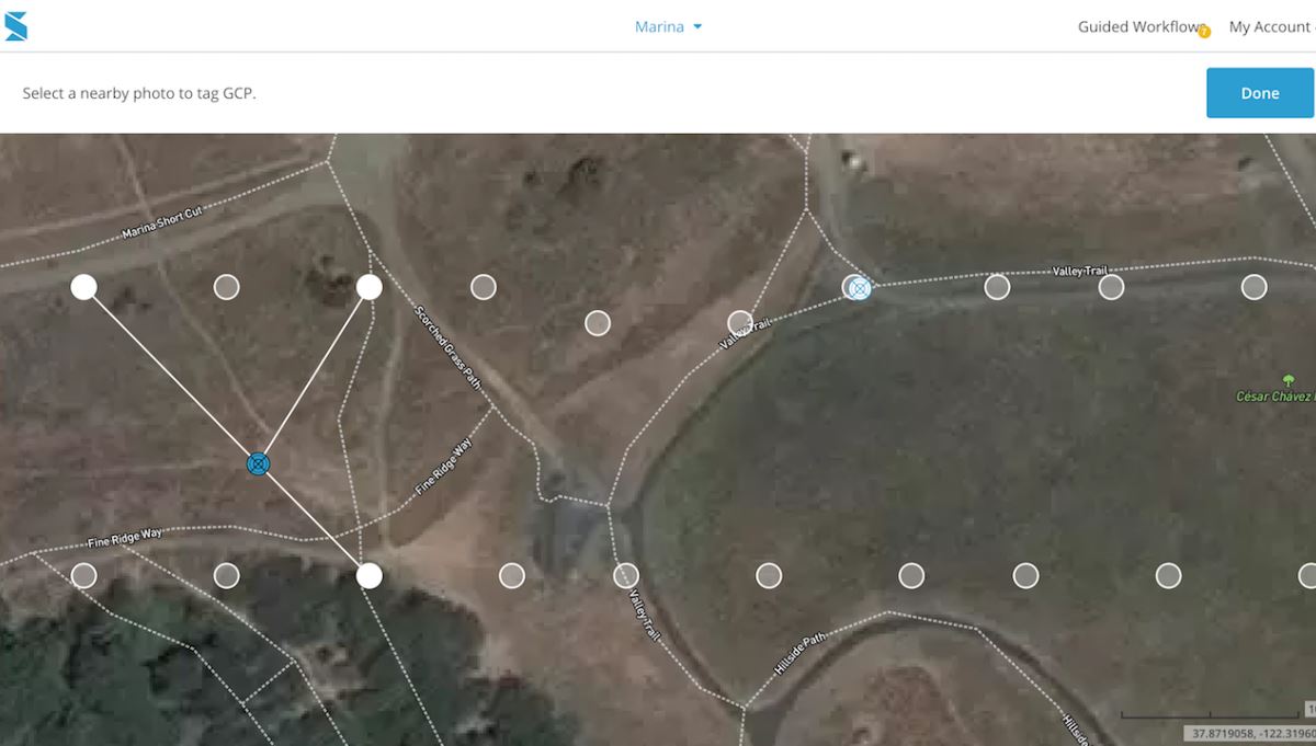
Last year, the company announced Site Scan’s support for ground control points (GCPs) to increase the accuracy of orthomosaics generated by Site Scan from a couple of feet down to “an inch or two.” On account of recent improvements to the system, Site Scan can achieve an horizontal accuracy of 0.25 inches and vertical accuracy down to 0.25 inches, while flying at 100 feet with the Site Scan Sony R10C and using GCPs.
“Ground control points are a game-changer for Site Scan," said Chris Swigert from Liberty Excavators. "Now, I can easily tag and process GCPs in the cloud, and deliver my clients more accurate drone maps and models than ever before”.
Alongside these improvements, 3DR also introduces “the fastest and easiest ground control point workflow on the market”: Lightning. This workflow is faster and more efficient than other current systems, as it allows users to tag GCPs 5x faster. According to the company, with Lightning users can “forget having to worry about slow, inefficient GCP processes: Lightning makes it easy for you to create deliverables that you—and your clients—will love.”
It’s interesting to see companies betting on the use of GCPs, while some others try to get rid of them as removing the need to lay ground control points saves about 75% of the time spent on data gathering with a drone.
If you want to check how Site Scan works, you can request a demo through 3DR’s website.


Comments