
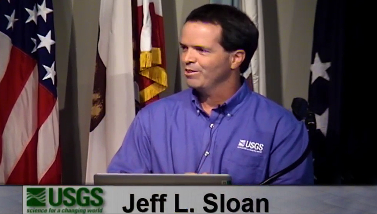
The best way to understand how much drones can do for mankind can only be seen when you get someone like Jeff Sloan to talk about their experience using them. From the new horizons drones open for farmers to the changes in wildlife protection, map making or pile counting at mines, Sloan has done it all. He’s a true pioneer within the United States Geological Survey (USGS) in terms of his efforts to position drones as eyes in the sky. A conference held last August, The New Eyes in the Sky: Putting Drones to Work for Scientific Research, gave Sloan the opportunity to share some of his experience with drones.
Sloan is a geographer and project leader at the USGS National Unmanned Systems Project Office. He has worked as a cartographer for the US Federal Government for more than 30 years. He began with the US Department of Defense, working with the Defense Map Agency and then the Department of Homeland Security, after which he went to the Customs and Border Protection Office in Washington DC. The majority of his career has been with the United States Geological Survey (USGS). His background is primarily in cartography, photogrammetry and remote sensing, especially pertaining to national and international mapping and monitoring. He has been involved with UAS operations since 2008 and in 2014 he took a position as project leader in Lakewood, Colorado.During the conference Jeff Sloan mentioned that “drones stir emotions, whether you love or you hate them,” but he has no doubt that UAVs are a new tool that scientists can put to good use. After connecting with Sloan though, we found out there were so many other considerations for him when it comes to leveraging drone technology for the USGS. From Military to Mapping“The USGS has been doing this work for about 8 years, although we started looking at it early in the 2000's,” Sloan told Commercial UAV News. “We were starting to attend conferences about this technology around that time, although the space was dominated by military technology. 2008 is when we set up our office, as we saw that it was going to be a big part of what our remote sensing program was going to be in the future. Our position was that anything that could get into the sky would be something we could put a camera on, and it would then be something we could work with. That's really the beginning of any type of mapping for us. It was a natural fit.”During the conference last August, Sloan said that the first drones used by the UAS National Project Office from the USGS came from the Army. The Army didn’t understand why the USGS would be interested in it, but that was because they had no idea that these tools could be used for mapping and to gather scientific data. They were only using it to capture video.Still, the Army felt curious about USGS’s interest and in 2009, they gave the project 17 Ravens in various conditions. Each system is comprised of three aircraft, meaning the new UAS National Project Office had enough aircraft to start business.“They told us they were going to destroy them, put them in a trench and run a tank over them,” Sloan continued. “I do not know if that’s true or not, but I like the story so I keep telling it. We came along and rescued them and put them to work for about five years. We made any modification we could to make those usable. We trained on those and we’ve been actively flying since 2011 and it hasn’t stopped. We turned down work on a regular basis because we’re simply overloaded.”The Ravens were not the only aircraft the project received. The Army also gave 22 T-Hawk systems along with a SuperBat, which is a larger fixed wing, from the National Institute of Standards. Many in Sloan’s department joked that they had become a dumping ground for technologies no one else wanted anymore, but it got them into the drone game at the right price. That opportunity was a critical one for him and the department, which is something the Department of Interior (DOI) has recognized. Gathering Better Data Across a Huge Area of LandThe DOI manages 1 out of each 5 acres in the United States. That’s 507 million acres of land. Various agencies have a connection to the federally managed lands, and drones have really helped scientists with their work and drastically changed how some research is implemented across these lands. Drones can gather an incredible amount of data in various ways, but Sloan sees tremendous potential with small UAVs that fly at 1,000 feet and below because of the opportunities they’ve opened up.“The ease of flying these things has really spurred a serious interest across the board,” Sloan mentioned. “Also, the sensor technology is moving just as fast if not faster than the hardware and software that takes these things into the sky and keeps them there. That's really our big interest, because we're seeing miniaturization and cost reduction that has really impacted the way we can approach the work we need to do. The quality hasn't suffered at all in this process, and in fact is even better.”FLIR cameras with thermal sensors, ideal for night flying and wildlife checking, and multispectral sensor cameras, which push near infrared, are accessible to almost anyone these days. Not long ago that type of camera was bulky and could reach six figures. Now though, the price points and size make them available for almost anyone to strap onto a drone, including the USGS.“The USGS has for a hundred years been interested in elevation data and topography,” Sloan said. “The resolution we're able to get now has been increased dramatically, partly because we're able to fly so low with these drones. Those resolutions are getting some attention from hydrologists and geologists. We've never been able to get at these levels with an aircraft. Maybe we could have done that with a balloon, but not a manned aircraft. So that low flight increases the resolution we're able to get. But when you start to put the wide gamut of the sensors that are available, including laser, radar and multi-spectral, and even handheld cameras, we're able to get different types of data, all of which are things we've never been able to do before. It's really changing our industry.”These smaller and relatively inexpensive drones are making things easier for Sloan and his team because of how they’re able to use the UAVs, and automation has made an impact in this area as well. There are times where they won't be on a joystick at all, and everything with the drone is running on a tablet. This kind of ease of use factors into the vision Sloan had for the technology when they first got their hands on it.“Our vision, 8 years ago, was that UAVs would be a tool used by scientists in a number of different ways and in a variety of fields,” Sloan mentioned. “Scientists will be able to pack up a drone just like any other piece of field equipment. Now that more policies have for the most part been straightened out, they'll be able to treat it like just another tool. Changing the camera to one they're familiar with or one they normally use is something they can easily do. We want drones to be a common, everyday tool that can be used, kind of like a GPS receiver is now.The policies that Sloan mentioned being straightened out related to the changes in FAA regulation, all of which became official in 2016 with Part 107. For the first time, non-hobbyist operators have a clear path to operate a drone, which has been a tremendous relief for officials like Sloan. He’s had to deal with a process that was no nearly as simple or easy.“We've been actively flying for 5 years,” Sloan continued. “Over that 5 year period within the Department of the Interior we did have to file for the waivers, and it could be a very painful process when we just wanted to fly in a very small area. It could take up to six months to get that approval. That morphed into a memorandum of an agreement that the DOI and a few other agencies set up with the FAA. A lot of the rules that we've been operating under are mimicking what we're seeing in Part 107. So much of what's there are things we've already been operating under, but Part 107 goes even further and makes it even easier to basically file and fly.” Drones as ToolsIt’s great to talk about the potential of drones and list out the capabilities these systems possess, but how is that potential actually being realized? What are some examples of practical fieldwork that is being done using drones?“Our first project was using the Raven,” Sloan said. “We were down in southwest Colorado looking at the sandhill cranes. And we first flew this during the day because we couldn’t fly at night, and it scared them. That’s a big issue, actually – scaring wildlife. And our U.S. Fish & Wildlife people who we’re working with are very sensitive to that. So usually we’ll start out really high and work our way down until we do see them disturbed. But it wasn’t working during the day, so we got a waiver to work into civil twilight – 30 minutes before or 30 minutes after sunset. And we found that they come back to the water and roost at night on the water. And when they’re on their roosts, they’re very calm. So we were able to fly clear down to almost 75 feet above them, and it didn’t disturb them – didn’t disturb them at all.”That efficiency and accuracy is important and something various officials recognized. Some of the Fish & Wildlife biologists were counting birds while the USGS team was flying. When the data sets were derived afterwards and compared, they were about 3 to 5% off. The experience led the U.S. Fish & Wildlife officials to understand that drones are a viable tool they can use. From studying trumpeter swan nesting sites, to looking at various wildlife refuges to counting pelicans in North Dakota, UAVs have proven to be useful tools when used appropriately. Ultimately though, it's about using the right tool for the right situation.After all, satellites have been used by researchers for a long time now. With manned aircraft, they were able to see improvements, but there was still a missing level, which was for things at 1,000 feet and below. Drones you can do things like get underneath trees and get underneath clouds. You can get into gulches that you'd never be able to go into with a manned airplane. It’s not about making comparisons though, because one isn’t better than the other. Sometimes they have to cover humongous areas, and that's just not feasible for a small drone.Drones are not going to revolutionize mapping or any scientific work, but they will make it more accurate, cost effective and safer. That last point is such a critical one that often gets overlooked, when it should be the first thing we consider. The DOI has tons of biologists, and the major safety issue they deal with surround biologists that are killed in aviation accidents.
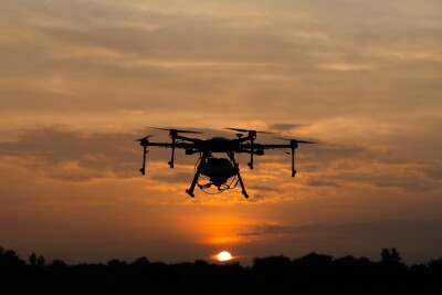
  The People FactorSafety might be the most important thing to consider when it comes to how drones are being used, but it absolutely is not the only consideration for the people who are using and seeing these tools utilized on various projects. The public’s reason to Sloan’s use of the technology is something he’s had to deal with directly.“I see the whole range of it,” Sloan explained. “I see people that are wondering what we're doing using drones at all, which often brings up privacy concerns. Anyone expressing those kinds of concerns might not want to have anything to do with them, but once we explain what we’re doing, they allow us to do it. Some people have no idea you can use drones for mapping. In those cases you have to start from scratch and explain it to people, but rarely do we get negative feedback after they understand why we want to use them. On the other side of, I've encountered people who are far more advanced than we are, and they're pushing the technology in ways that we might not even be ready to do. We see the whole spectrum.”At the same time as Sloan is dealing with reactions from the public that don’t realize what UAVs can and are doing, there’s also the reaction from users and even students once they’re able to take to the sky, but those are on a completely different level. Drones have that "wow" factor and allow users to generate excitement for and with the technology. Sloan mentioned that drones have helped reinvigorate their whole profession.“We've gotten a lot of new people interested in the kind of work we do because of drones, and there are several reasons for that,” Sloan said. “For one thing, they're fun to use, and it's getting to the point where the data we can get from them is even better than what we can get from systems that are much more expensive and difficult to use. That's made our work much more accessible.”That accessibility has created opportunities in the present and the future, and Sloan had a personal story to share about one of those opportunities. He related it to the small family farm he grew up on which his brother now runs. It never occurred to him to contract for an aerial flight over the farm, but flying a drone over it is something he thinks about on a regular basis now. It's something he can afford and fly and understands the data that comes off of it. The technology is really feasible, and that's making a huge difference.The opportunities in the present are incredible, and they’re being seen in various industries by numerous professionals. During a visit to Australia, for a mining conference, Sloan understood the importance drones have in that specific area. The speaker showed how with a drone, in a couple of hours, he could cover and map one area that would take, by conventional methods, a whole day to survey. There was a specific point he made which stuck with Sloan.“You either learn this technology, or you’re out of a job, if you’re a surveyor,” Sloan concluded. “That’s coming from someone with 25 years experience in the field.”


Comments