

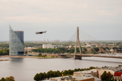
One of the sectors that has seen more widespread adoption of unmanned aerial vehicle (UAV) technology is powerline inspections. Why? Because conventional methods use costly helicopters and troops of foot inspectors supervising and documenting thousands of miles of transmission lines in some of the most isolated areas in the world. This is where an inexpensive aerial platform comes to the rescue. Equipped with high definition cameras and efficient gimbals, a conventional drone can closely inspect high voltage transmission lines standing 100 feet high in a few seconds.
The problem, of course, is the time that these readily available platforms can stay in the air. As a result, companies around the world are working feverishly, not only to extend flying time, but to find ways around the stubborn shortfall.
Commercial UAV News had the opportunity to talk to Nicolás Gonzalez, founder and CEO of Automapp in Chile. Automapp is a company that specializes in transmission and distribution line inspections in a country with a wide variety of extreme geographic features, including the Andes mountains, the driest desert on Earth, Atacama to the North and extreme Patagonia to the South.
“We decided to create Automapp after working for one of the largest electric distribution companies in Chile and identifying an untapped need for a more efficient way to inspect distribution lines,” said Nicolás with enthusiasm. “The company invested millions of dollars a year in vehicles and supervisors who spent their entire day inspecting transmission and distribution lines in remote areas. Unfortunately, there was a lot of resistance within the company to our idea to use drones, so we left our secure jobs and founded Automapp. At the beginning it was hard work, finding the right platform and the right sensor for the job at hand, but eventually we had a formula that worked pretty well in rural areas.”
Automapp landed its first client and initially their technology proved reliable and efficient. What the engineers at Automapp did was to combine Lidar, Thermography and still photography/Video to provide the customer with a complete picture of the transmission and distribution line condition, saving them countless person/hours and use of expensive land equipment.
But then came the big surprise that changed their business model in a radical way.
“After our initial success in remote locations, we received a call from the largest energy supplier in Chile with a request to perform the same job but in an urban setting!” said Nicolás with a big smile. “But the challenges were completely different, and our models and operation procedures didn’t adapt well to enclosed places and busy streets.”
Nevertheless, Nicolás and his partners went back to the drawing board and changed the operational parameters and field protocols to adapt them to a more densely populated environment.
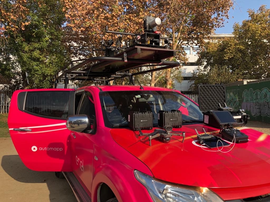
“What we did was to add all the tools that we had in the drone to a land vehicle and use it as if it were an aerial platform,” Nicolás explained. “Allowing us continuous long-range operations. This reduced the inspection time from 15 minutes per asset to just a few seconds. But this in turn created a problem of data generation and storage, so we decided to create a platform that would send the information constantly as it was generated to the cloud. From this, our cloud asset management platform and our new product Autocam was born!”
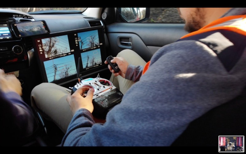
What allows Autocam to transmit data in real time is the cellular network density in most cities in Chile, which empowers the customer to see their asset data, well organized and geotagged, in three different formats in real time.
“Autocam allows the operator to deploy the drone only in those areas in which the asset to be inspected falls outside of the range of the land vehicle, thus creating a hybrid platform that allows the company to inspect assets in both urban and rural settings,” Nicolás elaborated. “The customer is extremely happy and now we feel confident that we can expand our portfolio of clients to other industries and who knows, maybe other countries too!”
By adapting their aerial technology to a land-based solution, Automapp engineers created a product, Autocam, that could be launched on demand and create the same uniform product regardless of acquisition platform. From the point of view of the customer, the asset is being inspected and the final product is always the same in real time; transparency of results always helps to overcome technological resistance.
For a more detailed explanation of the product, see Automapp's video below:


Comments