

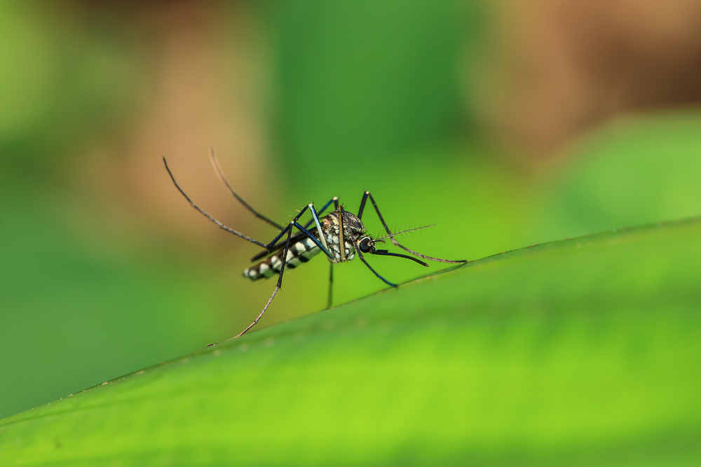
In the Florida panhandle, South Walton County provides the perfect landscape for mosquito breeding grounds. Swamps and other bodies of standing water are teeming with mosquito larvae that eventually make life outside unenjoyable for residents.
Normally, mosquito abatement teams enter these environments on foot, which can be densely forested and home to dangerous predators such as snakes and alligators. To minimize this kind of risk on the job, the South Walton Mosquito District has been using drone technology for the last two years as a new tactic for dropping abatement pellets in their service area.
To learn more about this unique drone use case, Commercial UAV News spoke with Benjamin Hays, a UAS coordinator with South Walton Mosquito District.
Hays works alongside one other drone operator, and he described their goal simply.
“We aim to serve the District by suppressing both pestiferous and disease-carrying mosquito populations to a tolerable level in the safest, most economical manner. [We utilize] a variety of methods in such a way as to minimize potential effects on people, wildlife and the environment while maximizing the value to the District's taxpayers.”
Throughout the county, the district has about 50 sites that they treat via drone. Hays and his team take a multi-pronged approach to their job. They rely on two drones, each with a distinctive purpose.
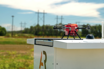
The treatment drone which carries and drops the pellets is a PV-40X made by Central UAS. This drone can carry up to 40 pounds, making it ideal for big jobs. To keep their treatment maps updated, they call on the Skydio X10 for mapping, surveillance, and 3D scanning. With this combined fleet, the district covers 593 acres of drone-accessible sites — part of a broader 1,061-acre service area that includes ground treatment. In 2025, the team treated 2,521 acres total with 21,500 pounds of product, nearly double the 1,218 acres treated in 2024.
In the future, Hays and his team will learn the ropes on aerial lidar to enhance their mapping database.
“Our current mapping program can't keep up with the ongoing construction, so the maps we're currently using are a little outdated. We try update our own maps with imagery through DroneDeploy, so that way we can actually see what's on the ground, and that is what’s most useful,” he explained.
Part of what makes accurate maps so important is to ensure that the treatment is landing in the right spot and not disturbing the surrounding environment.
“We do calibrations for the three different products that we use. Once we get the calibrations down, we record all the settings such our timer, our motor percentage, our door percentage, and how much is being put out at a time, which is pretty accurate,” Hays said
Operating with that level of precision requires not just technical skill, but also a clear understanding of where — and under what authority — these drones are allowed to fly.
While both Hays and his partner are Part 107 licensed pilots, they operate as a “public use” aircraft. A public use aircraft is owned by federal or state government and is exempted from FAA airworthiness certification and pilot licensing requirements. Just because their drones fall into this category, the district still takes the necessary precautions when flying.
“I operate under a Certificate of Authorization (COA). I have a spreadsheet that shows exactly what we flew and for how long we flew every day. This is totaled at the end of every month and at the end of the year for record keeping,” Hays told CUAV News.
He takes extra precautions when flying near the neighboring Air Force bases as well. Anytime they plan to fly near Class D Airspace, Hays makes quick phone call to the base to ask permission before taking off.
Despite the rules being a little blurry while operating under public use, safety and diligence are not something this district will brush under the rug.
That diligence extends beyond the airspace. When large drones are humming over residential neighborhoods and conservation areas, what people on the ground think matters just as much as what the drone is doing in the air.
Being that these drones are flying over some sensitive ecosystems, public perception is something the company manages daily. While their main goal is to make everyone more comfortable by killing mosquitos, there is still the potential for pushback. Thankfully, South Walton Mosquito District has a public information officer to help educate the community and answer questions when needed.
“Our public information officer runs our Facebook page and our website. Everyday she's out there scanning for anything related to our company, mosquito control, or drones,” said Hays.
“She'll put on our Facebook page every time that we're scheduled to do a treatment the next day and will include the area and the zone we will be in. Sometimes there'll be no comments, sometimes there will be lots of comments.”
For South Walton residents, the absence of mosquitoes can start to feel like a given — and that might be the greatest challenge Hays and his team face. As he put it, when people say they don't have a mosquito problem, his answer is simple: "Well, you're right — because we're doing our job."
As drone technology continues to evolve, programs like South Walton's offer a glimpse at what modern mosquito abatement can look like: more precise, less invasive, and a little harder to see coming.


Comments