

In the mad race to make uncrewed aviation profitable, some companies are finding niche markets that are possible today within the 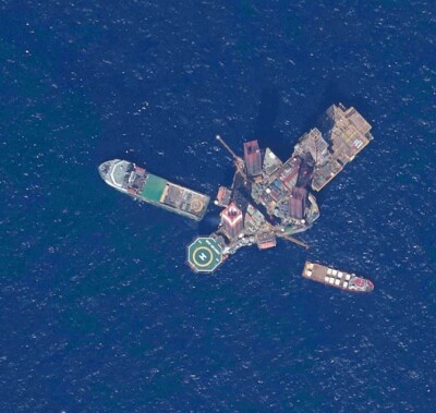 framework of federal aviation administration (FAA) regulations and the realities of public perception and safety issues.
Sub-industries such as agricultural spraying and rural package deliveries are having acceptable success rates given the nature of the environment in which the flight takes place and the specific conditions that surround the operation.
So, let us list the issues that contribute to increasing the chances that one specific mission would be successful or not:
- Operations over people (OOP). If your mission involves flying over populated areas, your chances of profitability and fast deployment diminish rapidly.
- Flying altitude. If your operation requires that the uncrewed aircraft flies high or very high, the objections from the regulator to your idea would increase exponentially.
- Ownership of the terrain below. If your mission involves flying over tens or even hundreds of properties of different ownership and jurisdictions, your logistical and jurisdictional nightmares have just begun.
In short, missions that do not operate over people and fly low, over a uniformly owned terrain have a greater chance of success than those that fly high, over populated zones and urban areas.
Agricultural spraying is the perfect example: the mission takes place at very low altitude, just a few feet over the plants being sprayed, the terrain is private, and you are flying with permission from the owner and there are absolutely no humans below your aircraft (hopefully!).
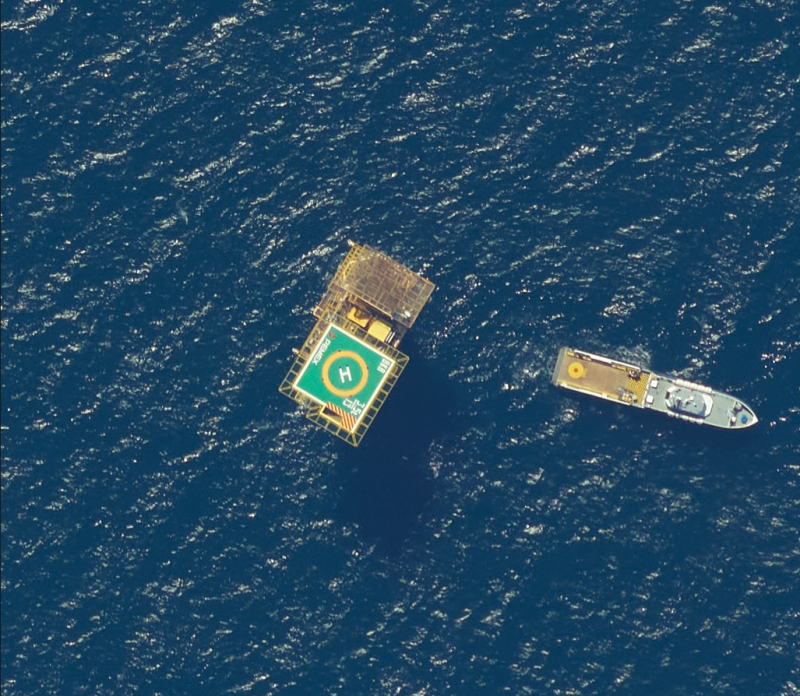
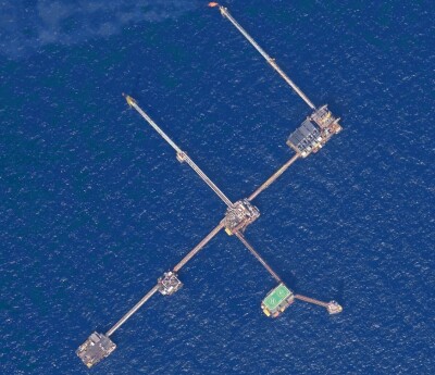
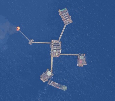
What other business possibilities are out there that comply with all three of these arbitrary parameters? Offshore oil rig supply comes immediately to mind. The flight might be performed at low altitude, over water and will take off and land on private property.
 So, why haven’t we heard more about this highly profitable industry taking off like a rocket? We decided to dig a little bit into the issue and found an interesting set of facts that would definitely delay these deliveries for a while.
First, most of these oil rigs and platforms were constructed decades ago before satellite navigation/surveying was a reality therefore their exact coordinates are unknown.
But how can that be? Well, these marine structures have been supplied and maintained by the same group of people over years, and the knowledge of their exact location has been passed from generation to generation in some haphazard way.
With the growing reliability of uncrewed aircraft, including extended flying times and higher useful payload of multi-rotors and fixed-wing, hybrid powerplant drones, oil companies are now eager to have these important oil-producing assemblies supplied in a more systematic and autonomous way.
There are over a thousand offshore platforms in the southern Gulf of Mexico that today are being supplied and maintained by boats that depart and arrive from the city of Ciudad del Carmen in Mexico by the owner and contractors that have been doing it for decades. The captains of these boats know the location of each rig by heart and when asked about how they get to each location, they just smile and say, “We know where they are.”
This is clearly a problem if you are trying to automate the operation.
In 2017, we were hired by the owner/operator of these crude producing structures to accurately locate them. We used a Citation jet flying at 10,000 ft and flying at 240 knots (276 mph) to accurately pinpoint and photograph over 50,000 square miles of water. Simultaneously, a land surveying crew placed ground control points (GCP) in some of these structures to add rigidity to, and increase accuracy of, the photogrammetric model.
 The resulting set of photographs and coordinates, accurate within an inch in X and Y and 1.5 inches in Z, would allow the oil company to begin operations using autonomous drones as soon as they have the right aerial platform to do so.
As you can see, there is a bit of preparation in order to implement some of these new aviation models and not every use case is ready for immediate implementation. The investment in a traditional photogrammetry mapping job must have been considerable but the resulting photographs and coordinates will be useful and accurate for a long time and will allow the company to save millions in supply issues over the next few years.
Companies that today are in the business of supplying these oil structures with boats and helicopters would be wise to add uncrewed aviation capabilities to their current offerings in order to maintain their competitiveness in an ever-changing aviation environment. Autonomous, remotely piloted aircraft are here to stay, and the savings they represent will make it impossible for oil companies to resist for too long.
In conclusion, we still need traditional photogrammetry methods to make autonomous or remotely piloted flying a reality, but in the end, we live in a world of dependencies and evolution, and it is only natural that we use one technology that has been around for decades to advance the next generation of technology that would be here for another long period of time until the next revolution comes around.

.jpg.small.400x400.jpg)


Comments