

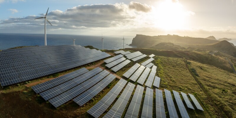
Renewable energy construction is, as one would expect, a complex job. A single wind farm can sprawl across 20,000 to 30,000 acres, involve hundreds of turbines, dozens of crews, miles of access roads, and years of development before a single blade turns. Keeping track of what was built, where, when, and by whom — and being able to prove it years down the line — is a challenge that goes well beyond a clipboard and a site visit.
For Aegean Energy Group, a renewable energy development and construction management firm based in Texas, drones have become a core part of the answer. The way the company got there, however, says as much about geospatial thinking as it does about uncrewed aircraft.
Woody Duncan, a GIS professional with more than 25 years of experience, co-founded Aegean Energy Group about a decade ago. The firm serves as the owner's representative across wind, solar, and large-scale transmission projects, with a team of civil engineers, electrical engineers, and construction specialists embedded on-site from groundbreaking through commissioning.
"We really are owners' rep," Duncan told Commercial UAV News. "We're putting folks on site before we break ground, all the way through construction, and then all the way to commissioning and operations."
That geospatial background is the basis for how the company approaches data on a project. The firm developed Maps to Megawatts, an Esri-hosted platform built on ArcGIS Online that centralizes engineering design plans, field observations, safety records, drone imagery, and inspection data into a single web-based environment accessible to the entire project team. The platform is a logical tool for the team, given, as Duncan puts it, everything they do is “so visual.”
The platform is designed to follow a project from early site prospecting through active operations, with drone data feeding directly into it at every stage.

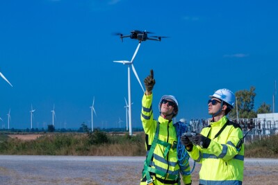
Aegean got into drones about eight years ago, Duncan said, initially to solve a straightforward problem. A project had a badly deteriorated access road, and a drive-through with a GoPro wasn't going to capture the detail needed to document conditions before construction began.
For Duncan, there is really only one question that matters when it comes to whether or not to deploy a drone for one of his projects: Is there tangible ROI?
"It could be the coolest thing on the planet. If it doesn’t [make money], it's not coming in the door."
Fast-forward to today, and that first use case has expanded into a comprehensive workflow that touches every phase of a project. Before breaking ground, Aegean uses drones to establish baseline site conditions. During construction, regular flights verify that work in the field matches the engineering plan. Post-construction, the imagery becomes part of the permanent project record.
The clearest example of direct financial value came from a wind farm project where Aegean flew before-and-after surveys to calculate exactly how much cropland each turbine pad and access road was actually displacing. Landowner agreements had assumed up to five acres of crop loss per turbine, but the drone data told a different story.
"We flew the project, and on average, we were finding that it was actually about 3.12 acres," Duncan said. "It's indisputable. In the eight years we've been flying drones, I've never seen a landowner or a federal agency or anyone be like, ‘No, that's not what it looks like.’"
Across a project with 300 turbines, the difference between the assumed acreage and the actual figure translated into significant savings on long-term landowner payments, which paid for the drone program many times over.
All of that drone data from each of these stages of the project flows into what Duncan describes as a “living digital twin.” The concept ultimately is the accumulation of everything: the engineering design, the construction documentation, the field observations, the inspection records, and the ongoing operational data.
"Full documentation, in particular post-construction, so that what you're actually seeing is the reality as it matches digitally the true world out there," Duncan said. "When we say digital twin, it has to be one of those things, to me, that it is a living thing."
On a wind farm where operations staff may number just one or two people managing hundreds of turbines, that living record becomes the institutional memory of the project, a resource for troubleshooting, inspection, and long-term asset management.
Aegean has operated primarily as a DJI shop, a choice driven in part by their durability in the high-wind conditions common to wind farm sites, where turbine tip heights can reach 500 feet, and flights regularly operate at 650 feet or above.
The FCC's placement of DJI on its Covered List creates a long-term planning question for operators like Aegean, something Duncan is keenly aware of. The fleet has delivered years of reliable service, and a transition to new hardware is a natural evolution rather than an emergency.
"It's been a natural progression," he said. "We really made the investment over the last six or eight years. We've done hundreds and hundreds of flights with a fleet of about eight or nine drones and really not had too many problems."
He is also watching Part 108 BVLOS rulemaking closely, though with a careful eye on safety and airspace management. His broader philosophy on navigating industry change is consistent: stay flexible, follow the technology, and do not lock into a single path.
"I'm riding the wave with Esri and with the drone industry as well in terms of just trying to be really nimble and flexible and not be committed down one path," he said.
What Aegean's approach ultimately demonstrates is that the value of a drone program in energy construction is ultimately about what you do with the data before, during, and after the flight. The ROI test Duncan applies to every use case, the GIS backbone that makes the data actionable, and the Maps to Megawatts platform that ties it all together have turned drones from a novelty into a core business tool.
As the industry looks toward more capable platforms and expanded operational authority, Duncan's parting thought is less about technology and more about stewardship.
"Education is a huge piece of it," he said. "At the heart of it: Why should I do this? Is it going to make me money or save me money?"
For Aegean, eight years of flights have already answered that question.


Comments